TabiFolk formerly called “Accessible Travel Forum” is a rich source of information sharing for disabled travelers and those serving them. “It is more than just a forum, it is a place for conversations. You can share great information you found, or ask for help from a local resident or a fellow traveler who went before you, you can even find a shoulder to cry on if you had a bad experience.” Thank you Josh for letting me know about this resource.
Author: Cecilia
The 25 Best Accessible Trails in America
The 25 Best Accessible Trails in America Outside Magazine Jan. 15, 2020 Beautiful article full of useful information by Emily Pennington
Outdoors for all
Outdoors for all: How national parks are addressing accessibility challenges. April 26, 2019 An article by Alexandra Charitan, Managing Editor at Roadtrippers Magazine.
Bryce Canyon National Park
Bryce Canyon National Park
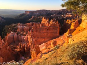
Situated along a high plateau at the top of Utah’s Grand Staircase, Bryce Canyon’s high elevation includes the largest concentration of hoodoos (irregular columns of rock) on Earth, numerous life communities, and dark skies.
Here is the Park website. Phone 435-834-5322 Map and Guide
Accessibility Printable Access Guide
![]() Mossy Cave 0.8 mile Streamside walk to mossy grotto
Mossy Cave 0.8 mile Streamside walk to mossy grotto
![]() Rim Trail 11 miles total. Connects Bryce Point to Fairyland Point
Rim Trail 11 miles total. Connects Bryce Point to Fairyland Point
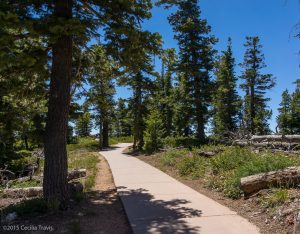
![]() Sunset to Sunrise Points .5 mile each way. Paved portion of the Rim Trail
Sunset to Sunrise Points .5 mile each way. Paved portion of the Rim Trail
![]() Queen’s Garden 1.8 mile the “least difficult trail that descends into the Bryce Amphitheater. Elevation loss/gain is 357′.
Queen’s Garden 1.8 mile the “least difficult trail that descends into the Bryce Amphitheater. Elevation loss/gain is 357′.
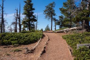
![]() Bristlecone Loop 1.0 mile. Partly paved trail with elevation gain/loss of 200′ Wheelchair-accessible with assistance. Not entirely ADA compatible.
Bristlecone Loop 1.0 mile. Partly paved trail with elevation gain/loss of 200′ Wheelchair-accessible with assistance. Not entirely ADA compatible.


Lee Metcalf National Wildlife Refuge MT
Lee Metcalf National Wildlife Refuge
“There are 2 ½ miles of nature trails in the Refuge’s Wildlife Viewing Area. The trails meander through meadows and river bottom woodlands along the Bitterroot River. The refuge is along the Glacial Lake Missoula National Geologic Trail and along two National Historic Trails – the Lewis and Clark Trail and the Nez Pierce Trail. ”
Here is the Refuge website. Description from OhRanger! Phone 406-777-5552
The 2 ½ miles of nature trails in the Refuge’s Wildlife Viewing Area are described as easy and flat.
![]() Kenai Nature Trail 1.25 mile the first 0.5 is mile paved and wheelchair-accessible.
Kenai Nature Trail 1.25 mile the first 0.5 is mile paved and wheelchair-accessible.
Wildfowl Lane is a Ravalli County road that travels almost 3 miles through the southern half of the refuge.
Pinckney Island National Wildlife Refuge SC
Pinckney Island National Wildlife Refuge
“The 4,053 acre refuge includes Pinckney Island, Corn Island, Big and Little Harry Islands, Buzzard Island and numerous small hammocks.” “There are several biking and hiking trails. A trail network of 2 to 10 miles traverse the island. The trails are easy and flat, and appeal to even novice hikers. The salt marsh environment is lush with birds and other wildlife.”
Here is the Refuge website . Phone 843-784-2468 Description on “Oh Ranger!“.
Trail Guide and Map The eight trails are all said to be “easy, flat”. Here are the two shortest:
![]() Ibis Pond 1.2 miles round trip
Ibis Pond 1.2 miles round trip
Flathead National Forest
Flathead National Forest
“The Flathead National Forest contains three wilderness areas, two ski areas, impressive mountain ranges, lakes, wild and scenic rivers, campgrounds, picnic areas, and cabins.”
Here is the Forest website. Supervisor’s Office 406-758-5208
Tally Lake Ranger District phone 406-758-5204
Glacier View Ranger District, Hungry Horse Ranger District, and
Spotted Bear Ranger District (winter) 406-387-3800
Spotted Bear Ranger District (Summer) 406-758-5376 (summer)
Swan Lake Ranger District 406-837-7500
Here is a brochure listing a few trails in the Forest with “gentle to moderate” slopes. The following “comply with Forest Service Trail Accessibility Guidelines”
![]() Round Meadow Trail 1 – 13 miles
Round Meadow Trail 1 – 13 miles
![]() Krause Basin Interpretive Trail 0.3 mile
Krause Basin Interpretive Trail 0.3 mile
Lake Conastee Nature Park
Lake Conastee Nature Park
“Lake Conestee Nature Park consists of approximately 400 acres of beautiful natural habitat on the Reedy River just 6 miles south of downtown Greenville, South Carolina. The park contains both hardwood and evergreen forest, extensive wetlands, 3 miles of the Reedy River, and a rich diversity of wildlife habitat.”
Here is the Park website. Map “The park contains both hardwood and evergreen forest, extensive wetlands, 3 miles of the Reedy River, and a rich diversity of wildlife habitat. Deer, raccoon, beaver, fox, river otter, and various small mammals inhabit the park, along with numerous species of reptiles and amphibians. Over 200 bird species have been reported…”
![]() Breazeale Farm via Swamp Rabbit Trail and TreeFrog Trail Map options of 1.8 miles or 1.58 miles. Churchill to Brushy Creek is paved.
Breazeale Farm via Swamp Rabbit Trail and TreeFrog Trail Map options of 1.8 miles or 1.58 miles. Churchill to Brushy Creek is paved.
![]() Forrester Farm via Raccoon Run & Dragonfly Way. Map options of 0.67, 0.98, and 1.44 miles.
Forrester Farm via Raccoon Run & Dragonfly Way. Map options of 0.67, 0.98, and 1.44 miles.
![]() Henderson Farm via Whitetail Trail, Swamp Rabbit Trail, and Spring Lizard Link. Map options of 1.05 mile and 1.13 mile.
Henderson Farm via Whitetail Trail, Swamp Rabbit Trail, and Spring Lizard Link. Map options of 1.05 mile and 1.13 mile.
Sesquicentennial State Park
Sesquicentennial State Park
Sesquicentennial State Park, affectionately known to locals as “Sesqui,” is a spacious, green getaway in the heart of the Sandhills region.
Here is the Park website . Phone 803-788-2706 Map Trail Map Brochure Trails
![]() Sandhills Hiking Trail 2 miles “This resurfaced and stroller-friendly trail circles the park’s 30-acre lake. Hikers, bikers and joggers will enjoy the sights and sounds of the Sandhills as they venture into the forest and through wetlands on boardwalks.”
Sandhills Hiking Trail 2 miles “This resurfaced and stroller-friendly trail circles the park’s 30-acre lake. Hikers, bikers and joggers will enjoy the sights and sounds of the Sandhills as they venture into the forest and through wetlands on boardwalks.”
![]() ? Loop Trail 3.5 miles “This multi-use trail uses an existing roadbed great for joggers, hikers and bikers. See a diverse array of plants and wildlife as you circle through the park’s forests and wetlands. USE CAUTION! Part of this trail is open to vehicles.”
? Loop Trail 3.5 miles “This multi-use trail uses an existing roadbed great for joggers, hikers and bikers. See a diverse array of plants and wildlife as you circle through the park’s forests and wetlands. USE CAUTION! Part of this trail is open to vehicles.”
![]() ? Jackson Creek Nature Trail 0.5 mile “This trail is a short loop through a bottomland forest area, upward into an open pine habitat and ending with a scenic view of Centennial Lake. There are interpretive signs to help you learn about the unique plants and animals that call Sesqui home”
? Jackson Creek Nature Trail 0.5 mile “This trail is a short loop through a bottomland forest area, upward into an open pine habitat and ending with a scenic view of Centennial Lake. There are interpretive signs to help you learn about the unique plants and animals that call Sesqui home”
Uinta-Wasatch-Cache National Forest
Uinta-Wasatch-Cache National Forest
“The Uinta-Wasatch-Cache National Forest is one of the 12 National Forests in the Intermountain Region as well as one of the urban National Forests in the Forest Service System. It covers an area that includes northern and north-central Utah, and southwestern Wyoming.”
Here is the Forest website. Supervisor phone 801-999-2103 Contacts in the various ranger districts.
There is a video on the website describing 5 Family Friendly Trails which they say are good for strollers and people of all ages. At one point the voice-over claims they are “universally accessible”, but that is not clear from the photographs or the descriptions on the website.
![]() ? Limber Pine Nature Trail 1.4 miles
? Limber Pine Nature Trail 1.4 miles
![]() ? Cascades springs interpretive trail 0.9 mile paved and boardwalk path
? Cascades springs interpretive trail 0.9 mile paved and boardwalk path
![]() Devils Kitchen Trail to a geologic site 0.1 mile “Accessible”
Devils Kitchen Trail to a geologic site 0.1 mile “Accessible”
![]() ? Current Creek Nature Trail 1.25 miles self-guided interpretive trail. Call 435-654-0470 for more information on this trail.
? Current Creek Nature Trail 1.25 miles self-guided interpretive trail. Call 435-654-0470 for more information on this trail.
![]() “Summer Lake Nature Trail 3/4 mile around a lake
“Summer Lake Nature Trail 3/4 mile around a lake