White River National Forest

White River National Forest
“White River National Forest is the most visited national forest in the nation encompassing 2.3 million acres. With 11 ski resorts, eight Wilderness areas, 10 mountain peaks over 14,000 feet and 2,500 miles of trails, this forest is a place where you can press play on adventure and inspiration!”  Here is the Forest website.   Phone for the Forest Supervisor’s Office in Glenwood Springs is 970-945-2521.

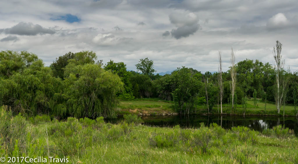
Tenmile Canyon National Recreation Trail at Black Lake Number One
Thanks to Bob King who provided all the following information and photographs:
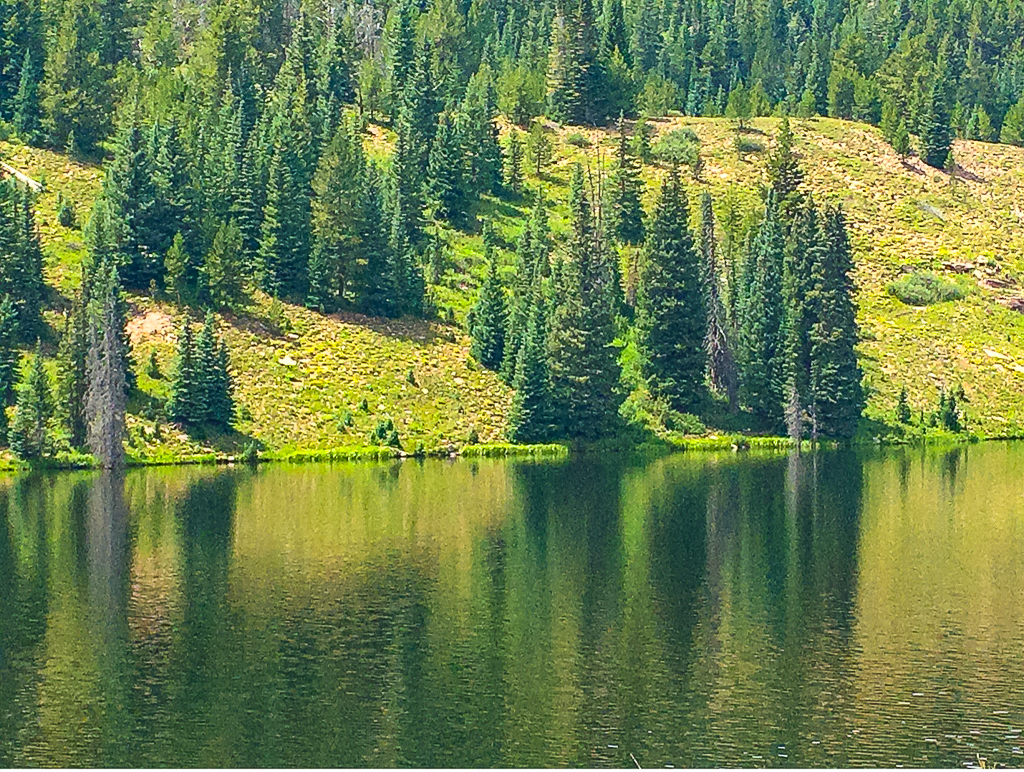
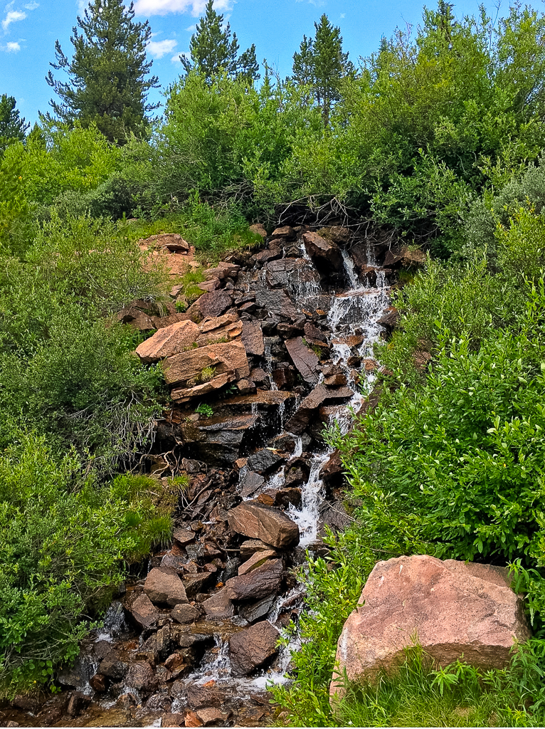
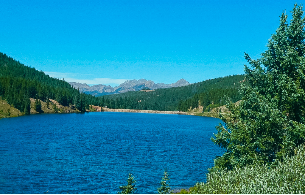
The Tenmile National Recreation Trail, is paved and extends for 18 miles, connecting to other paved trails.  It passes by Black Lake, altitude about 10,500″. The lake is a beautiful spot with a fishing pier and quite a few wildflowers. We’ve also seen Bald Eagles flying above the trees.  Watch for bicyclists and stay on the right-hand side of the path   Weekdays and late summer after schools are in session are less crowded times to go.
We park in a gravel lot below the dam…. There is no handicapped parking designation and there is a little lip up from the gravel lot onto the trail.  We get to this spot from the Vail Pass exit off I 70 and then take the frontage road short distance to Black Lake.   There are two other parking areas, but this is the safest place for wheelchairs, next to the gate that restricts car traffic. There is also a picnic area here. More information.

Views from paved wheelchair accessible trail around Black Lake Number One
Reflections from evergreens across the lake. © Robert King 2021
A small waterfall along the shared path. ©Robert King 2021
View of the surrounding forest and mountains looking north across Black Lake showing the dam and a bit of the trail on the right/east side. © Robert King 2021
Butterfly on a golden aster near the lake. © Robert King 2021

Roosevelt National Forest

Roosevelt National Forest
The Canyon Lakes Ranger District of the Roosevelt National Forest in north central Colorado includes the Pawnee National Grasslands, Pingree Park, the Red Feather Lakes area and Big Thompson and Estes Park.  The Poudre Wilderness Volunteers post an informative website describing these areas.  Phone for the Canyon Lakes Ranger District is 970-295-6700.
Pawnee National Grasslands   I have a separate post about this area.  Look for it above this post.
Pingree Park contains Colorado State University’s Mountain Campus.   Map
Comanche Lake  1.1 miles to the lake, 1.6 miles if you go around the lake.  Here is a detailed description of the trail.
Red Feather Lakes
Lady Moon Trail is 2.6 miles between the two trailheads, but you may just want to hike a mile or mile and a half from the Elkhorn Creek Trailhead.   Half a mile from the Lady Moon trailhead and about 1.5 miles from the Elkhorn Creek trailhead the trail takes an elevation gain which may be more strenuous than you want.  Here is a description.
Mt. Margaret Trail 3.8 miles downhill! to the summit  You may want to just hike the first 1.5 miles to avoid an uphill return.  Most of this trail is on an old roadbed .   Forest Service description.  Location Map  Described on AllTrails    and on HikingProject.
You can gain access to the easy-sounding Columbine Trail Complex from the Mt. Margaret trail, but that is probably a longer hike than you want to take.  These trails are also mostly old roads.
Here is a map of the Red Feather Lakes area.
Lily Mountain
Lily Mountain Trail is pretty level for the first mile before climbing over 800′ to the summit in just one more mile.  Description  Road map showing the trailhead.

Pawnee National Grassland

Pawnee National Grassland
The Pawnee National Grassland in northeast Weld County, Colorado is part of the Roosevelt National Forest and has the accessible Trail of the Mourning Dove and a Birdwalk in the Crow Valley Recreation Area.  The grassland is a part of the short grass prairie and a fine location for spring wildflowers and for birding.  Wildlife includes pronghorn, bison, prairie dogs and many others. The Buttes, which rise about 300 feet above the plains are erosional remnants of the High Plains.   They consist of the soft clay-rich Brule formation overlain by the sandstone and conglomerates of the Pawnee Creek and the Arikaree formations.
Be sure to call ahead to learn of trail conditions and of seasonal closures.  Here is the website.   Phone 970-834-9270   Map
Crow Valley Recreation Area
Wheelchair AccessibleTrail of the Mourning Dove Short trail from the Steward J. Adams Education Site along the usually dry Crow Creek”
Wheelchair AccessibleBirdwalk Trail  Short walk across a dry creek bed and into a cottonwood stand.
Pawnee Buttes Trail
1.5 mile trail to the first butte and 2.1 mile to “slightly beyond the eastern base of the western Pawnee Butte.  The trail is rated  easy or “easy to intermediate” depending on which reference you find.   Here is a detailed description.   Call ahead to learn more.

Arapaho & Roosevelt National Forests – Mount Goliath

Arapaho & Roosevelt National Forests – Mount Goliath
Mount Goliath  is a beautiful area right at timberline on the road towards Summit Lake.  The area immediately around the Nature center is accessible and the close by trails are easy walking.  Mt. Goliath is famous for its ancient bristlecone pines and alpine garden.   Interpretation displays and an accessible restroom are available in the Dos Chappell Nature Center.  The garden is managed by the Denver Botanic Gardens in conjunction with the U.S. Forest Service.  A call to the Clear Creek Ranger District 303-567-4382 will let you know if the road is open.   Here is the website.

Bristlecone pines from wheelchair accessible parking lot, Mt. Goliath area, Mt. Evans, Colorado
Bristlecone pines, Mt. Goliath area, Mt. Evans, Colorado
Accessible patio Dos Chappel Nature Center, Mt. Goliath Arapahoe National Forest, Colorado
Photographer Jack Olson at Goliath Park on the Accessible patio at Dos Chappel Nature Center, Mt. Goliath, Arapahoe National Forest, Colorado


Wheelchair AccessibleA limited area is wheelchair accessible.  The path through the garden is easy.

Arapaho & Roosevelt National Forests

Arapaho & Roosevelt National Forests
These mountain Forests in north central Colorado include popular destinations such as Guanella Pass, Alpine Central Railroad Grade trail, Brainard Lake Recreation Area and the Mount Goliath Natural Area.
Supervisor’s Office 970-295-6600. The National Forests website.    Links to Maps
Brainard Lake Recreation Area  Although trails leading from Brainard Lake are not particularly easy, you can  enjoy walking around the lake’s margins.  Watch out for moose!  Here is their website.
Alpine Central Railroad Grade  As long as you want to do, but 3 miles to Pavilion Point.  The trail starts at Silver Plume and goes 13 miles to Mt. McClellan.  Here it is described by the Hiking Project.
Guanella Pass   Most of the trails from the top of Guanella Pass are too long and steep in places to be included here.  However, it is an easy drive from Georgetown to the parking lots at this above-timberline destination,  There are flowers and beautiful views and a toilet!  Here is a description of some trails that lead off of the pass.  And another website about the pass area.
Rainbow Lakes Trail c 2.6 miles round trip along a series of 9 small lakes and beaver ponds.  Said to be easy but rocky in places.  Another place to watch out for moose. It is north of Nederland.   Phone 303-541-2500.  Reviewed by AllTrails.   Here is the Forest Service’s description and directions, but they have accidentally included it in the webpages for Lincoln National Forest in New Mexico.

Look farther down this Federal section to see listings specifically for Roosevelt National Forest and the Pawnee National Grasslands.

Medicine Bow-Routt National Forests WY

Medicine Bow-Routt National Forests
From mountain ranges to grasslands and crystal clear streams, the national forests and national grassland provide abundant and unique opportunities for visitors.
Here is the Forests website.  Phones:  Forest supervisor 307-745-2300
From stateparks.com: “The Medicine Bow-Routt National Forests extend from north central Colorado to central Wyoming. The Forests encompass portions of many mountain ranges including the Gore Range, Flat Tops, Parks Range, Medicine Bow Mountains, Sierra Madre, and Laramie Range.”
Unfortunately, this branch of the Forest Service gives very little information on trails.  Here is the page with links to information each trail, but they seldom give length, let alone difficulty rating.
Brush Creek/Hayden Ranger District  307-326-5258  
Snowy Range Scenic Byway  also described here
Wheelchair AccessibleMirror Lake Picnic Ground includes an accessible  path to the water,  campsites and fishing platform.
Wheelchair AccessibleLake Marie Trail goes along the southeast shore of the Lake

Brooklyn Lake Road 3.5 miles described as easy in Hiking Project.

Douglas Ranger District  307-358-4690
Laramie Ranger District  307-745-2398
Medicine Bow Trail is a 23  mile Rail-Trail from Laramie to Coalmont Colorado. Hiking Project description. 

Arapaho National Wildlife Refuge Complex

Arapaho National Wildlife Refuge Complex in northern Colorado and  southern Wyoming has an accessible trail and some ADA compliant overlooks.  The Hutton Lake National Wildlife Refuge has an easy hiking trail.   These refuges are part of a refuge complex that includes one refuge in Colorado and four in southern Wyoming.  The headquarters are in Walden, Colorado.   Phone 970-723-8528.  Here is their website.
Arapaho National Wildlife Refuge is south of Walden, Colorado in North Park, an intermountain glacial basin with an elevation ranging from 8,100 to 8,700′.
Phone  970-723-8202
Wheelchair AccessibleMoose-Goose Nature Trail  0.5 mile “…winds along the Illinois River, provides a great chance to view song birds and other riparian residents.”
There are three ADA compliant overlooks and an accessible viewing blind.
Hutton Lake National Wildlife Refuge
2.6 miles of hiking trail. “It is possible to hike all or portions of the system. The flat to gently sloping terrain makes it enjoyable for all hikers.”  Here is the website for Hutton Lake.

Dinosaur National Monument

Dinosaur National Monument
Dinosaur National Monument has one wheelchair accessible trail and numerous easy trails. The monument lies on the border between Colorado and Utah at the confluence of the Green and Yampa Rivers. just to the north of the town of Vernal, Utah. There are over 800 paleontological sites in the Jurassic Morrison formation. There are fossils of many dinosaurs including Allosaurus, Deinonychus, and Abydosaurus.  Dinosaur National Monument protects 105 miles of the Green and Yampa rivers and more than 210,000 acres of the rivers’ canyons.
Phone 435-781-7700  Map  Accessibility   Links to trail details     Monument website
Wheelchair AccessiblePlug Hat Trail  0.25 mile loop paved  “…trail on top of a butte affords excellent views of the surrounding landscape and provides an introduction to the pinyon pine-juniper community.”
Cold Desert Trail  0.5 mile loop  “This short, level walk provides insight into the diversity of the desert shrub community found around Dinosaur National Monument.”
Box Canyon Trail 0.5 mile in and out.  “A level walk into a shady box canyon.”
Gates of Lodore Trail  0.75 mile one way.  There are a “few steps” at the beginning of the trail and then it is a level walk above the Green River ending at a view of the entrance to Lodore Canyon.
Hog Canyon Trail  1.5 mile one way.  “A relatively level walk into a box canyon.”

Comanche National Grasslands -Vogel Canyon

Comanche National Grasslands – Vogel Canyon
Vogel Canyon, a tributary of the Purgatorie River Drainage, has the easy Overlook trail and three other hiking trails going to the canyon bottom or along the mesa top.  There are two permanent springs located at the bottom of the canyon, which support a variety of wildlife.  American Indians lived in the canyon 300 – 800 years ago and left rock art which is visible on the canyon walls.
Here is the Forest Service Website  and another website with lots of information.
Wheelchair Accessible“The Overlook Trail is a one mile round trip. This trail is handicapped accessible and consists of a gravel walkway along the top of canyon.”  the trail goes through shortgrass prairie and juniper trees and ends at the top of a small cliff with a view of the canyon.  Here is a trail description from All Trails.

Wheelchair accessible Overlook Trail to Vogel Canyon, Comanche National Grasslands
Vogel Canyon photographed from wheelchair accessible Overlook Trail, Comanche National Grasslands, CO
Vogel Canyon from wheelchair accessible Overlook Trail, Comanche National Grasslands, CO

Two Ponds National Wildlife Refuge

Two Ponds National Wildlife Refuge    
Wheelchair Accessible
The refuge is divided into two areas, both of which have accessible trails.  The Prairie Management Area is open dawn to dusk all year.  We went in October and were disappointed to learn that the more interesting Two Ponds area is only open May through September and then only Tuesdays through Saturdays from 8:00 a.m. to 4:00 p.m.  Dogs are not allowed on the refuge. Described on National Recreational Trails site.  Reviewed on Trip Advisor
Map   Phone 303-289-0232

View from easy trail on the Prairie Management area of Two Ponds National Wildlife Refuge
View from Prairie Management area of Two Ponds NWR
Pond from easy hiking trail, Two Ponds National Wildlife Refuge, Arvada Colorado
Two Ponds National Wildlife Refuge, Arvada CO


Easy hiking trail along the Highline Canal at Two Ponds National Wildlife Refuge
The Highline Canal crosses Two Ponds NWR