Notice: Function _load_textdomain_just_in_time was called incorrectly. Translation loading for the mfbfw domain was triggered too early. This is usually an indicator for some code in the plugin or theme running too early. Translations should be loaded at the init action or later. Please see Debugging in WordPress for more information. (This message was added in version 6.7.0.) in /hermes/walnacweb05/walnacweb05ae/b91/traviswe49833/accessiblenature/wp-includes/functions.php on line 6131
Notice: Function _load_textdomain_just_in_time was called incorrectly. Translation loading for the google-analytics-dashboard-for-wp domain was triggered too early. This is usually an indicator for some code in the plugin or theme running too early. Translations should be loaded at the init action or later. Please see Debugging in WordPress for more information. (This message was added in version 6.7.0.) in /hermes/walnacweb05/walnacweb05ae/b91/traviswe49833/accessiblenature/wp-includes/functions.php on line 6131
Notice: Function _load_textdomain_just_in_time was called incorrectly. Translation loading for the wptouch-pro domain was triggered too early. This is usually an indicator for some code in the plugin or theme running too early. Translations should be loaded at the init action or later. Please see Debugging in WordPress for more information. (This message was added in version 6.7.0.) in /hermes/walnacweb05/walnacweb05ae/b91/traviswe49833/accessiblenature/wp-includes/functions.php on line 6131 California local - Accessible Nature Deprecated: Function WP_Dependencies->add_data() was called with an argument that is deprecated since version 6.9.0! IE conditional comments are ignored by all supported browsers. in /hermes/walnacweb05/walnacweb05ae/b91/traviswe49833/accessiblenature/wp-includes/functions.php on line 6131
Deprecated: Function WP_Dependencies->add_data() was called with an argument that is deprecated since version 6.9.0! IE conditional comments are ignored by all supported browsers. in /hermes/walnacweb05/walnacweb05ae/b91/traviswe49833/accessiblenature/wp-includes/functions.php on line 6131
City of San Jose The city of San Jose, California has a trail system of over 57 miles of recreation and active transportation opportunities. Here is the city’s Website and their Trail Network .
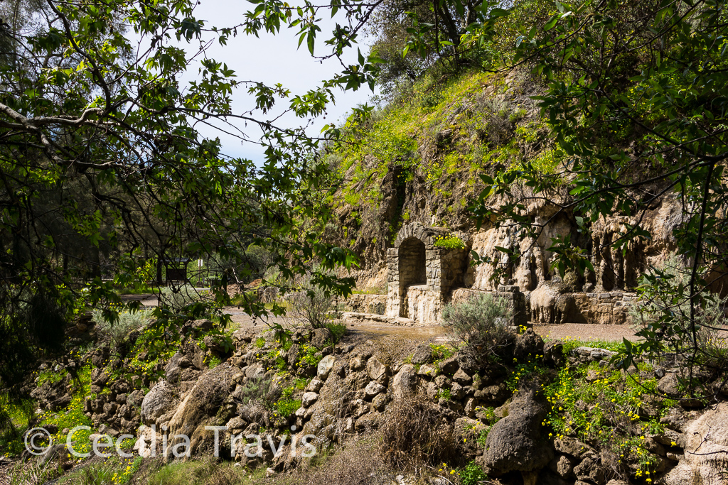
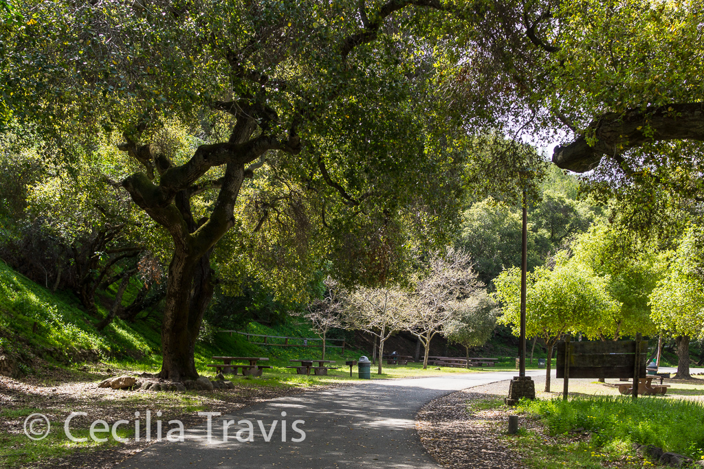
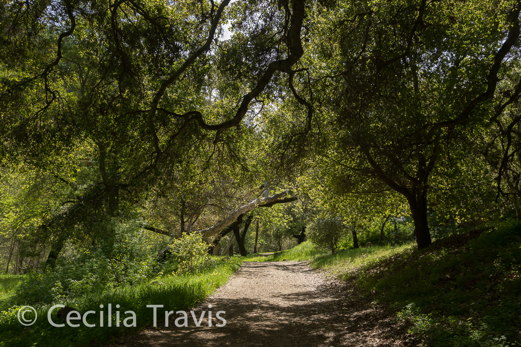
Alum Rock Park is about five miles from downtown San Jose. The lower trails alongside the Penitencia Creek are paved and shady. Where the pavement leaves off, there is still lovely and easy hiking as well as challenging, steep trails. The park is in a canyon in the foothills of the Diablo Mountain Range. There are many wild animals including mountain lions, bobcats, and deer. Pets are not allowed. Ranger office phone 408-259-5477.
Here is the Park’s website. Trail Map
Easy trail Alum Rock Park, San Jose, CaliforniaPaved accessible trail Alum Rock Park, San Jose, CaliforniaEasy trail, Alum Rock Park, San Jose, California
Bear Yuba Land Trust
The Bear Yuba Land Trust in Nevada County, California includes at least four accessible trails in the areas where the non-profit, membership-supported organization has acquired land to conserve “the region’s natural, historical and agricultural legacy.” According to helpful people with the land trust, the trails listed below are “… ADA friendly but may not meet all ADA standards”.
Phone 520-272-5994 Here is the Trust’s Facebook page and their websiteTrails PortalTrails Location Map Litton Trail 2 miles one-way. “A well-established trail through an informal urban greenbelt in the vicinity of the Sierra College campus in Grass Valley.” Independence Trail WestIndependence Trail East “Independence Trail transformed an historic gold mining ditch into the nation’s first identified handicapped-accessible wilderness trail. It is now one of the most popular trails in the area, contouring along wooded hillsides, passing live streams, and crossing deep gorges on restored wooden flumes that once transported water for hydraulic mining. The trail has two separate sections — West and East — that extend from one main trailhead on Highway 49.” “West trail is wheelchair accessible in dry months from the trailhead to a short way beyond Flume 28 (about 1.1 miles one way).”
“Like the Independence Trail West, the East trail follows the gentle gradient of an old mining ditch and is wheelchair accessible. It offers occasional views of the South Yuba River canyon and passes seasonal side streams and bogs. Tree cover and a generally northerly orientation keep the trail relatively cool and green for its 1400-1500 foot elevation.” Thank you to Rosemary Mendonca who wrote with this sad news, “…much of this wonderful trail sustained damage in the \”Jones\” wild fire last year and it is closed to the public. They intend to repair and rebuild but it\’s unknown when it will reopen. https://activenorcal.com/historic-independence-trail-destroyed-in-northern-californias-jones-fire/https://www.bylt.org/independence-trail/“ Penn Valley Bike Trail 1.7 miles one way Not really a natural trail, the description of its environment is “commercial and residential areas with some areas of oak woodland and pines.” Western Gateway Park Trail A small town park with lots of grassy fields and a creek running though it. The fitness trail of about a mile round trip goes through “Mixed oak woodland and pines, riparian forest, and landscaped areas.”
Nevada City
Nevada City, California backs onto the Tahoe National Forest and has many accessible trails within or near the town. The city website lists a number of trails you can access walking from downtown or via a short drive. “The good news with all of these outings is the accessibility to the outdoors and proximity to in-town coffee shops, restaurants, wineries, pubs, art galleries and theaters.” Here is the city website’s listing of area trails. By clicking on the hiking boot by this map of Nevada County you can see all the trails in the county. Here is another map showing the location of trails in the Nevada City and Grass Valley area.
Hirschman Trail “The eastern 0.4 mile of trail is constructed to ADA standards, providing barrier-free access to Hirschman’s Pond.” Map Cascade Canal Trail 4.5 miles one way. “…an almost level walk along a peaceful canal through a forest with many Douglas firs and dogwoods. At 3200′ elevation, it is a bit higher and cooler than many local trails.” Map Independence Trail – East and West. See Bear Yuba Trust Map
City of Anaheim
Oak Canyon Nature Center
Oak Canyon Nature Center’s Main Road is accessible for strollers and wheelchairs. The 58-acre natural park is in the Anaheim Hills. The park consists of three adjoining canyons and there is a year-round stream. There are four miles of hiking trails which traverse one of the few remaining areas of oak woodland and coastal sage scrub in this region. There is an interpretive center, a small museum with live animals and regional natural history exhibits.
Here is Anaheim’s website and here is the website for Oak Canyon Nature Center. Phone 714-998-8380 Trail guide Main Road 0.7 mile ” bisects the center of the canyon, offering hikers an open view. The road is level and accessible to both strollers and wheelchairs.”
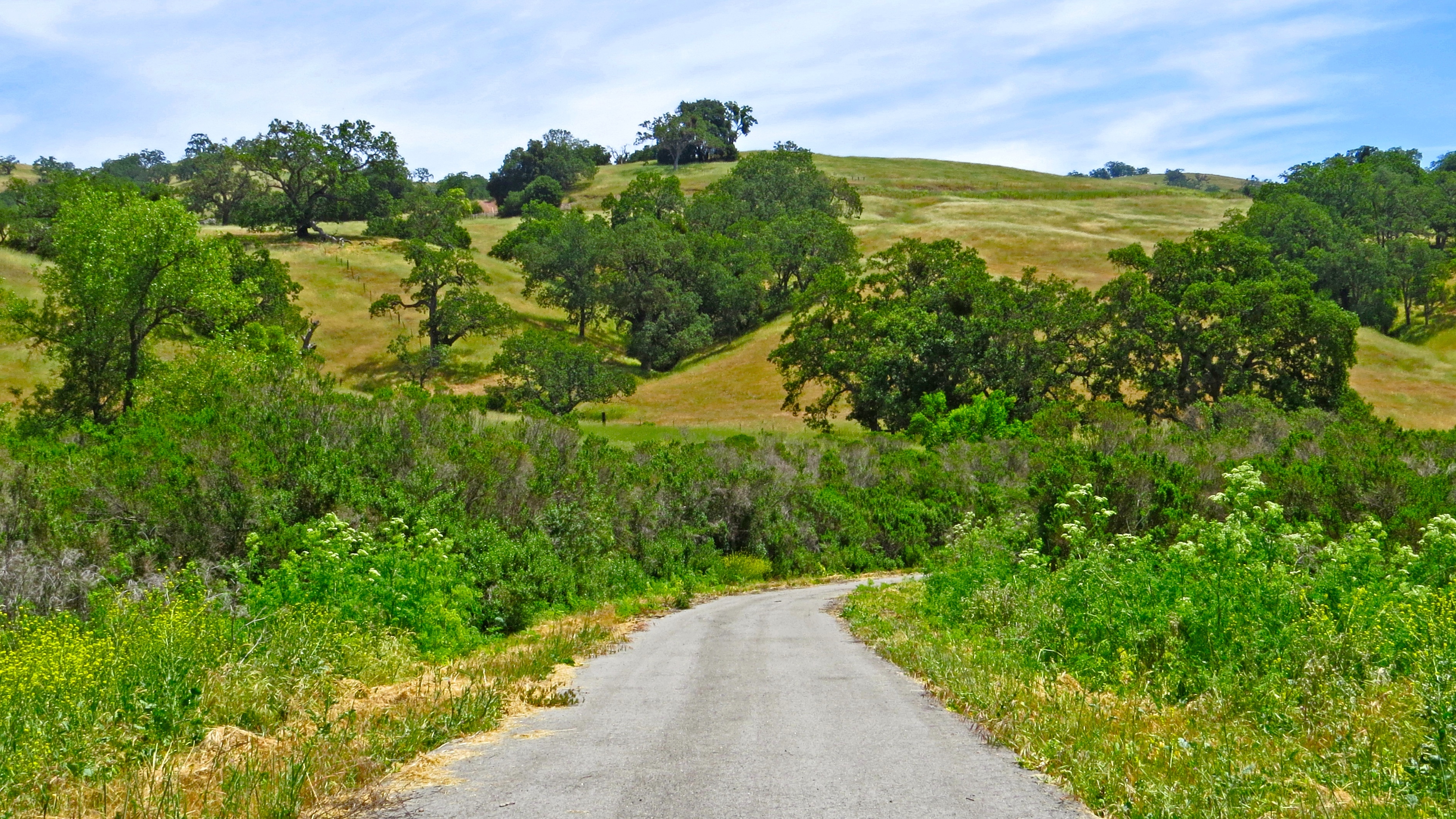
Santa Clara County Parks
The regional parks system includes 28 regional parks encompassing over 52,000 acres. ” Regional parks are larger in size, usually more than 200 acres, than local neighborhood or community parks. Many of the County’s regional parks also feature points of local historic interest.” Here is their Park Finder tool for finding a park that fits your activity preference. Here is the County parks website.
In response to my inquiry, they sent this helpful reply:
“We do make every effort to design and build trails that meet grade and width requirements. The following is a short list of recently constructed trails and paved pathways that offer opportunities for those with disabilities requiring the use of mobility devices. Paved; Los Gatos Creek trail, Coyote Creek, Penitencia Creek, Martin Murphy at Coyote Lake, Harvey Bear Ranch. Natural surface trails; Coyote Lake Harvey Bear-Campground trail, Valley Oak, Calaveras, Rancho La Polka trail via the southern segment of the Mendoza trail. Sanborn County Park-John Nicholas trail and the Indian Rock trail.” The Joseph D. Grant County Park, also known as Grant Ranch Park is in the Diablo Range foothills of the eastern Santa Clara Valley. Thank you to Mark Heir for the lovely photos. Here is a video he shot as he explored this park .
City of Palo Alto “Palo Alto’s open space preserves offer a chance to hike from the marshes of the bay to the redwoods of the upper Santa Cruz mountains.” Baylands Nature Preserve near Palo Alto – According to Wikipedia, this preserve is the “largest tract of undisturbed marshland remaining in the San Francisco Bay.” Here is Mark Hehir’s video of the accessible paths and many of the birds to be found there. Phone 650-329-2506 This is their website. Palo Alto Open Space and Parks
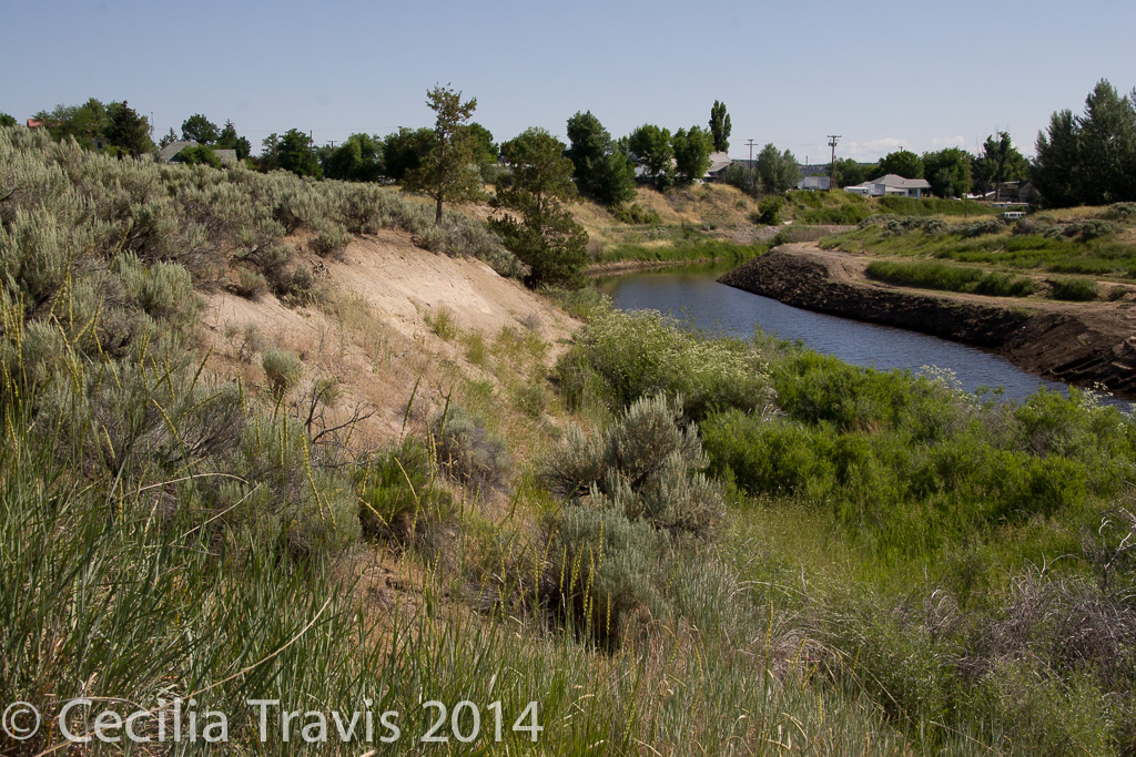
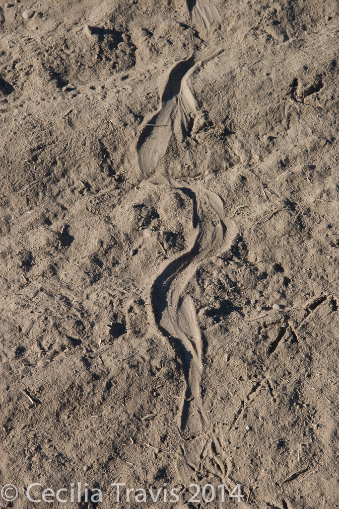
Modoc County The River Center in Alturas offers a wealth of programs and information about the surrounding area, including the Pit River Watershed, Modoc County and Siskiyou County in California, Lake County and Klamath County in Oregon. The center is now housed in the Modoc Historical Museum, 600 S Main St, which is wheelchair accessible. Call 530-233-4314 ext. 115 for hours and other information. There is an easy walking path along the Pitt River, but is very soft sand and probably would be difficult for a wheelchair.
Pitt River, AlturasSnake and quail trails in soft sand by Pitt River