Arkansas Headwaters Recreation Area
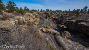
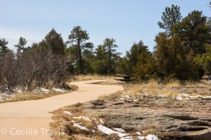
The AHRA has a variety of trails for outdoor recreation.
![]() Hayden Meadows “at the northern end of AHRA, has ADA accessible interpretive and fishing trails, 5 wetland boardwalks, and 2 bridges surrounding a small reservoir.”
Hayden Meadows “at the northern end of AHRA, has ADA accessible interpretive and fishing trails, 5 wetland boardwalks, and 2 bridges surrounding a small reservoir.”
Phone 719-539-7289 Map & Brochure
Category: Colorado State
Ridgeway State Park
Ridgeway State Park Phone 970-626-5822 Trails Map Brochure and Trails Map
![]() Mear’s Bay Trail 1.0 mile concrete trail that “winds along the shoreline of Mear’s Bay in the Dutch Charlie area. Waterfowl such as Western grebe, Canada geese and great blue heron can be seen here during the more quiet hours of the day. Enjoy beautiful views of the San Juan Mountains reflected in the bay.”
Mear’s Bay Trail 1.0 mile concrete trail that “winds along the shoreline of Mear’s Bay in the Dutch Charlie area. Waterfowl such as Western grebe, Canada geese and great blue heron can be seen here during the more quiet hours of the day. Enjoy beautiful views of the San Juan Mountains reflected in the bay.”
![]() Marmot Run Trail 1.8 mile that “runs along the east shore of the Uncompahgre River and the Ridgway Reservoir.”
Marmot Run Trail 1.8 mile that “runs along the east shore of the Uncompahgre River and the Ridgway Reservoir.”
![]() River Walk 0.2 mile runs along the Uncompahgre River
River Walk 0.2 mile runs along the Uncompahgre River
![]() ? Forest Discovery Trail 0.6 mile is a steep, up to 12% grade, self-guided nature walk, but has a “compacted – firm” surface with no obstacles. It is next to the Dutch Charlie Visitors Center, so you could ask there about difficulty.
? Forest Discovery Trail 0.6 mile is a steep, up to 12% grade, self-guided nature walk, but has a “compacted – firm” surface with no obstacles. It is next to the Dutch Charlie Visitors Center, so you could ask there about difficulty.
Steamboat Lake State Park
Steamboat Lake State Park Phone 970-879-3922 Trails Map and Brochure
![]() Willow Creek Trail 3.8 miles total
Willow Creek Trail 3.8 miles total
![]() ? Tombstone Nature Trail is a self-guided interpretive trail described on the park’s website as 1.1 mile and easy to moderate. Trails.com describes it as 0.75 miles and easy. The trail has its own Facebook page.
? Tombstone Nature Trail is a self-guided interpretive trail described on the park’s website as 1.1 mile and easy to moderate. Trails.com describes it as 0.75 miles and easy. The trail has its own Facebook page.
Mueller State Park
Mueller State Park Phone 719-687-2366 Short Trails for the Family Trails Map


![]() Dragonfly Loop 0.20 mile a very short paved trail, but a pretty spot good for fishing, birding, wildlife and flowers.
Dragonfly Loop 0.20 mile a very short paved trail, but a pretty spot good for fishing, birding, wildlife and flowers.
There is some elevation loss/gain on all these next trails. Check with the Visitor Center to see if they are easy enough for you.
![]() School Pond Trail 1.61 mile wide and gentle
School Pond Trail 1.61 mile wide and gentle
![]() Elk Meadow Loop 2.38 miles
Elk Meadow Loop 2.38 miles
![]() Wapiti Trail 0.8 mile self-guiding nature trail which drops drops down about 200′ before climbing back up. There are 3 granite steps at the bottom which you can bypass without too much difficulty. Be sure to use your trekking poles.
Wapiti Trail 0.8 mile self-guiding nature trail which drops drops down about 200′ before climbing back up. There are 3 granite steps at the bottom which you can bypass without too much difficulty. Be sure to use your trekking poles.
Barr Lake State Park
Barr Lake State Park
Barr Lake State Park surrounds a 1900 acre reservoir ringed with Cottonwoods, marshes and aquatic plants. It is a favorite with the birding community.
You can ride their “Eagle Express” (like a golf cart seating 14) for a naturalist guided tour. It is available in warm weather on weekends. Call 303-659-6005 for information.
Here is the Park website. Phone 303-655-1495 or 303-659-6005 Trails Brochure and Map
![]() ? Although the road around the 9 mile perimeter of the lake is not officially ADA compliant, it is a hard pack dirt and small gravel road and outside of serious mud and snow times shouldn’t pose a problem. From the Nature Center to a Gazebo reached by a boardwalk over the water is 1.2 miles. In fair weather this includes a spectacular view of the Front Range, but even on a poor day, the lake, waterfowl and old cottonwoods make a pretty walk. There is an accessible blind for wildlife observation.
? Although the road around the 9 mile perimeter of the lake is not officially ADA compliant, it is a hard pack dirt and small gravel road and outside of serious mud and snow times shouldn’t pose a problem. From the Nature Center to a Gazebo reached by a boardwalk over the water is 1.2 miles. In fair weather this includes a spectacular view of the Front Range, but even on a poor day, the lake, waterfowl and old cottonwoods make a pretty walk. There is an accessible blind for wildlife observation.
![]() Niedrach NatureTrail is partly boardwalk, and once current improvements are made, may also become wheelchair accessible, although it is a little narrow in places.
Niedrach NatureTrail is partly boardwalk, and once current improvements are made, may also become wheelchair accessible, although it is a little narrow in places.
![]() Fox Meadows Trail is easy walking, but includes a few steps.
Fox Meadows Trail is easy walking, but includes a few steps.
Staunton State Park
Staunton State Park phone 303-816-0912
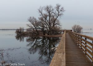
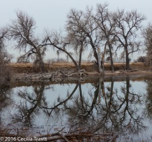
Staunton State Park, north of US285 near Shaffer’s Crossing, is the most recently opened of Colorado’s state parks. The park features high grassy meadows at 8,100 feet in altitude to granite cliffs over 10,000 feet. “Staunton State Park’s varied geology, soils, water features, and climate support rare and unexpected plant communities and a rich diversity of wildlife…”
Although not listed as “accessible” several of the trails are smooth and easy. We walked just the lower first 2 miles of the Staunton Ranch trail, which meant a 4 mile round trip and my (then) 88 year old husband had no problem with it. Here is the Park’s website. There is a 20′ by 12′ ADA access fishing pier at the Davis Ponds. AllTrails’ description Park Brochure Trail Map Leashed pets are allowed.
![]() A wonderful new development at Staunton is their motorized track chair. Call ahead to reserve the chair, which can be used on 10-15 miles of trail within the park. There is no extra charge other than the park’s pass required of everyone.
A wonderful new development at Staunton is their motorized track chair. Call ahead to reserve the chair, which can be used on 10-15 miles of trail within the park. There is no extra charge other than the park’s pass required of everyone.
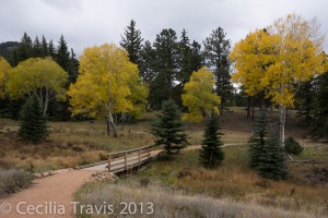
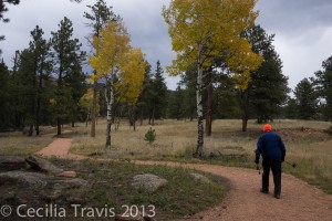
![]() Davis Ponds Loop trail 2.3 miles is easy and has been recently improved. There are a couple of places that might be a little steep without brakes, but I have seen steeper labeled “wheelchair accessible”.
Davis Ponds Loop trail 2.3 miles is easy and has been recently improved. There are a couple of places that might be a little steep without brakes, but I have seen steeper labeled “wheelchair accessible”.
Roxborough State Park
Roxborough State Park
This beautiful park near Denver is a designated National Natural Landmark. “The park, with close to 4000-acres, is filled with dramatic red-rock formations, distinct plant communities, and a host of wildlife ranging from black bears to mule deer.” There are accessible restrooms and a visitor center. The park is day use only. Phone 303-973-3959 Here is the park website. Trails Brochure and Trail Map
![]() ? The Fountain Valley Trail is basically a 2.3 mile dirt road and can be wheelchair accessible with assistance during dry seasons. There may be some erosion in places, so be sure to call ahead. It does not qualify for ADA designation.
? The Fountain Valley Trail is basically a 2.3 mile dirt road and can be wheelchair accessible with assistance during dry seasons. There may be some erosion in places, so be sure to call ahead. It does not qualify for ADA designation.
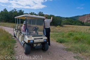
You can ride this trail in the “Roxborough Ride”, a golf cart seating 6 guests and a volunteer driver/naturalist guide. Although the Ride is free, donations are requested. Each disabled person must be accompanied by an able person to help them on and off the cart. The ride is usually scheduled for Saturdays and Sundays and reservations are wise. Call the park, 303-973-3959, for more information.
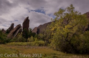
![]() Although the shorter Willow Creek trail is not wheelchair accessible, I have done it with a walker. Roxborough is truly beautiful and surprisingly peaceful, given its proximity to Denver.
Although the shorter Willow Creek trail is not wheelchair accessible, I have done it with a walker. Roxborough is truly beautiful and surprisingly peaceful, given its proximity to Denver.
Eldorado State Park
Eldorado State Park
Eldorado State Park, near Boulder west of highway 93 is a day use park which offers hiking between sandstone cliffs, picnicking along along South Boulder Creek and views of climbers on spectacular rock exposures. GPS at entrance station: N39° 55.923 W105° 16.839.
Here is their website. Phone 303-494-3943 Trails Map and Brochure
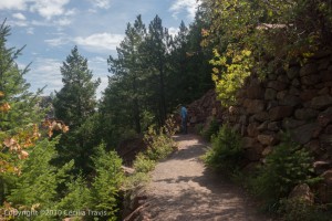
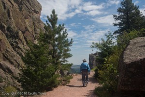
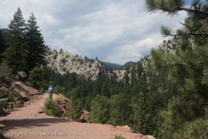
![]() The Fowler Trail is a self-guided nature walk built for wheelchair use. There is one rather narrow spot, but I was assured that people negotiate it without problems. It is about 1/2 a mile long and has great views. Bring your own binoculars as the two telescopes set up for viewing raptors (or climbers) on the other side of South Boulder Creek are too high for viewing from a wheelchair.
The Fowler Trail is a self-guided nature walk built for wheelchair use. There is one rather narrow spot, but I was assured that people negotiate it without problems. It is about 1/2 a mile long and has great views. Bring your own binoculars as the two telescopes set up for viewing raptors (or climbers) on the other side of South Boulder Creek are too high for viewing from a wheelchair.
Chatfield State Park
Chatfield State Park
This state park surrounds Chatfield Reservoir, southwest of Denver. Together they comprise 3,895 acres of water and mostly flat land. Recreational activities here include hiking, horseback riding, fishing, boating, swimming and camping. Chatfield is a good place for birding. Wildlife includes muskrat, coyote, foxes, white-tailed deer and bear.
Phone 303-791-7275 Park website Trails Trail Map Park Brochure
![]() The Chatfield Internal Trails network is 10 miles of ADA accessible paved trail. The Chatfield Dam Trail is 2.4 miles of ADA accessible asphalt.
The Chatfield Internal Trails network is 10 miles of ADA accessible paved trail. The Chatfield Dam Trail is 2.4 miles of ADA accessible asphalt.
Castlewood Canyon State Park
Castlewood Canyon State Park
Castlewood Canyon State Park near Franktown, Colorado has wheelchair accessible trails as well as more difficult hikes into the canyon. The park is the site of the Castlewood Dam which burst in 1933, sending the waters of Cherry Creek into Denver in a 15′ wave. Leashed pets are welcome on most trails. The east side, where the Visitor Center is, has two concrete-paved trails, picnic tables, an amphitheater, and an easy walking trail. Here is their website. Trails Map Phone 303-688-5242
![]() The Canyon View Nature Walk is 1.2 miles between parking lots and is ADA accessible.
The Canyon View Nature Walk is 1.2 miles between parking lots and is ADA accessible.
![]() The Bridge Canyon Overlook trail is 400 ft one way.
The Bridge Canyon Overlook trail is 400 ft one way.
![]() The first few hundred feet of so of the Lake Gulch trail, leading north from the parking lot has spectacular views of Pikes Peak. Eventually it drops down in a set of difficult steps.
The first few hundred feet of so of the Lake Gulch trail, leading north from the parking lot has spectacular views of Pikes Peak. Eventually it drops down in a set of difficult steps.
