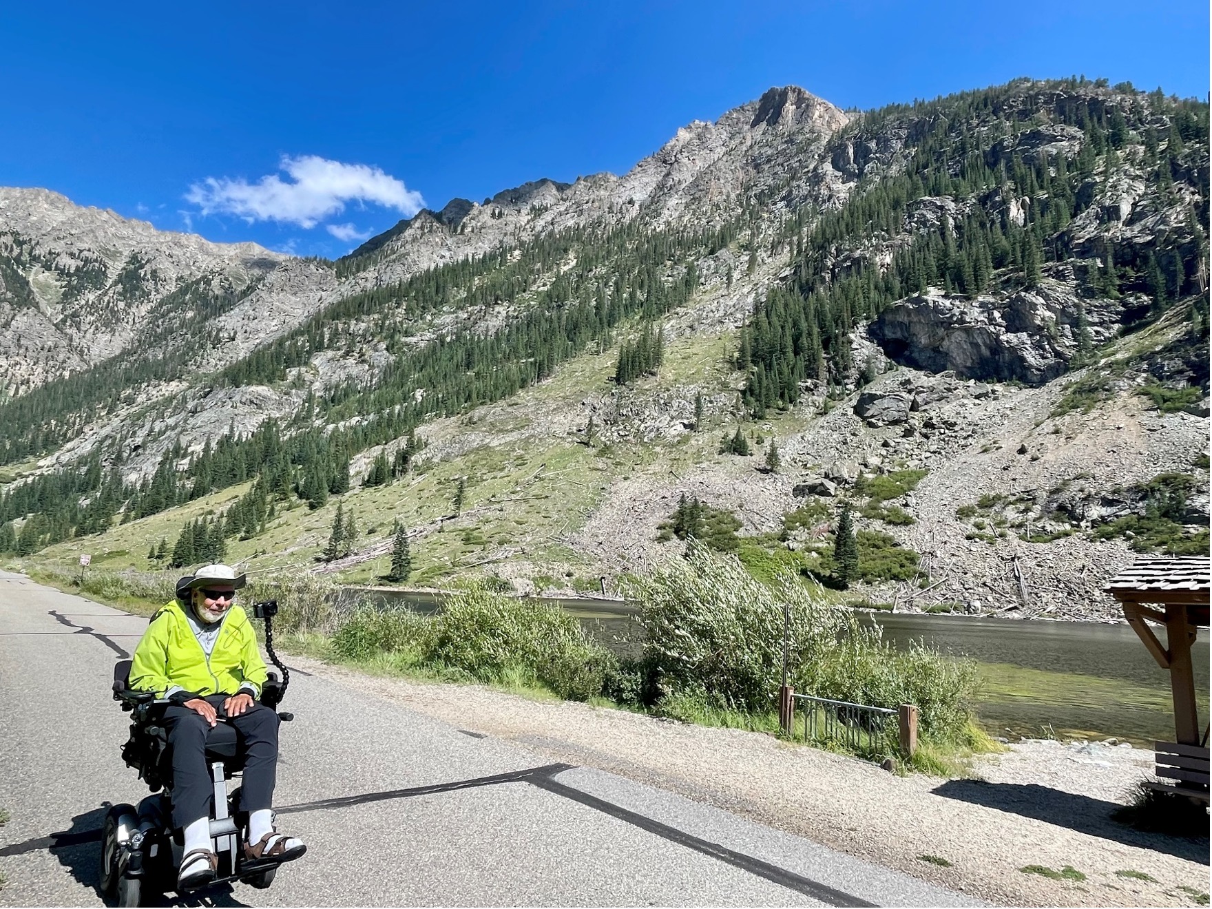
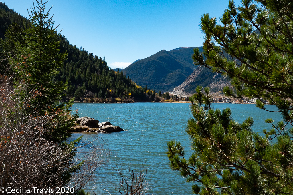
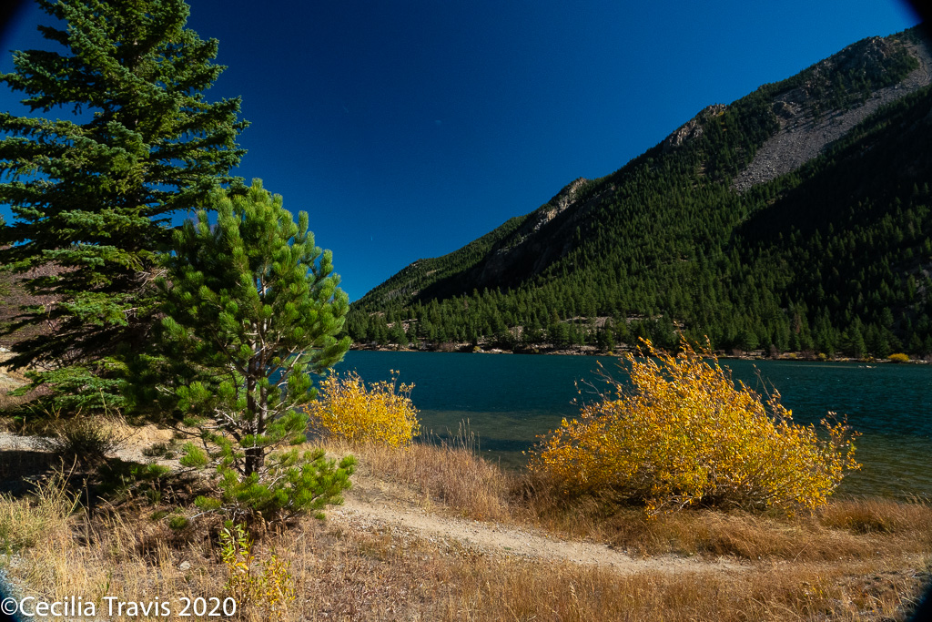
Summit County

Summit County
Wheelchair AccessibleSummit County maintains an extensive paved Recreational Pathway System, commonly known as the Recpath.  Elevations range from 8,777 feet to 10,563 feet,
Thank you to Robert King who wrote, “There are many miles of paved, wheelchair accessible trails [in] Summit County Colorado that I did not see listed on your website. An introduction to all of them can be found at ….”Summit County Recreational Pathway website.
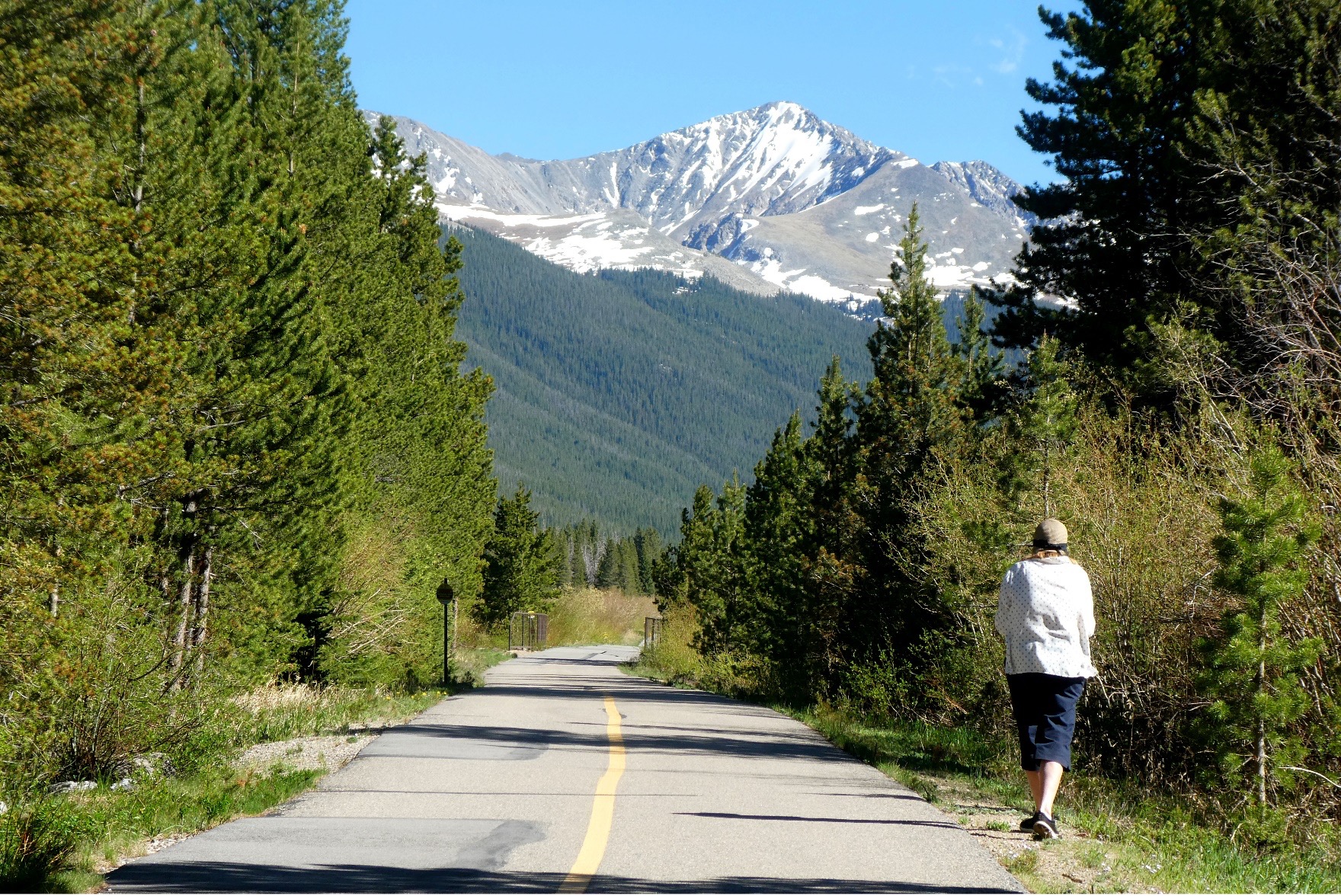
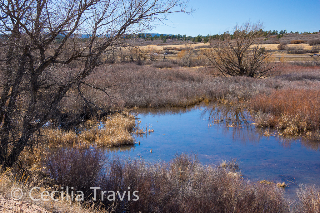
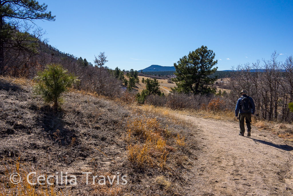
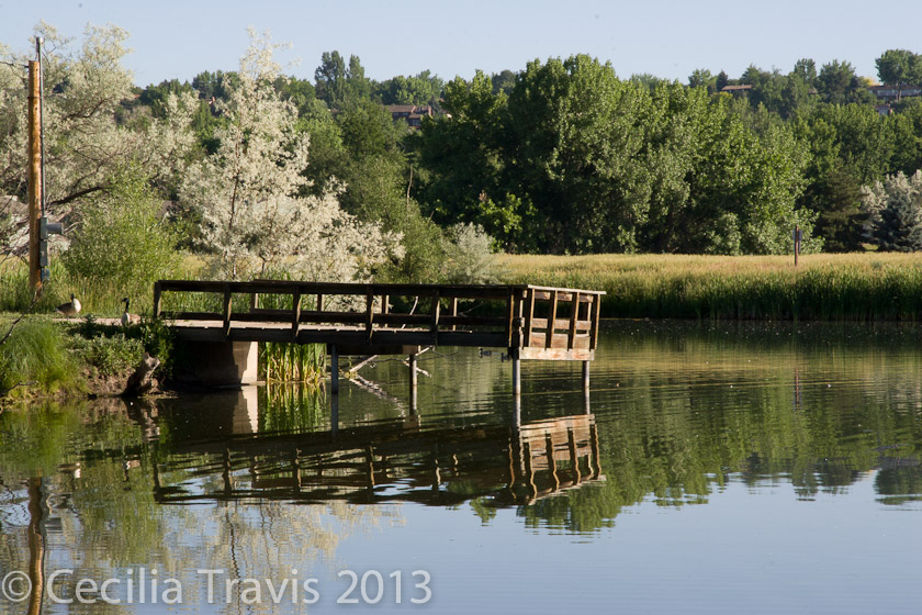
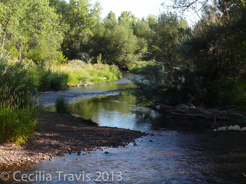
Wheelchair AccessibleBlue River Trail from North Pond Park
Thanks again to Robert King for the following post:
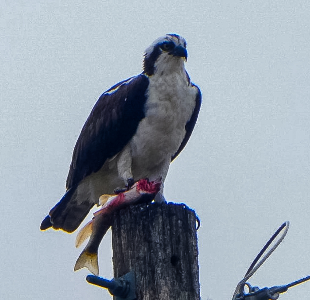
“The Blue River Trail runs 3.5 mi from North Pond Park through downtown Silverthorne, CO to the Lake Dillon Dam, where it connects with the Summit County Recreation path  The Blue River Trail runs 3.5 mi from North Pond Park through downtown Silverthorne, CO to the Lake Dillon Dam, where it connects with the Summit County Recreation path.  North Pond Park is located at the intersection of Highway 9 and Hamilton Creek Road.  It is a wetland and pond area with fishing for humans and ospreys.  There is a paved parking lot with handicap spaces along with 2 pavilions, restrooms, 2 docks, and a gas fire pit. Travel a short distance on the sidewalk along Hamilton Creek Road to the trail crossing. From there travel south toward the town of Silverthorne. The trail skirts housing developments as follows the Blue River. After 0.7 mi, the path goes onto a street and we turn back.”

Osprey seen from wheelchair accessible Blue River Trail
Osprey Dining on Sushi at North Pond ©Robert King
Wheelchair AccessibleTen Mile Recreation Trail
Ten Mile Canyon is an 11.8 mile portion of the 55-mile long Summit County Recreational Pathway System.  Robert King writes:  “A paved recreation path runs about 6 miles through the Ten Mile Canyon between Frisco and Wheeler Junction. This posting is from the Wheeler junction area where we park in a gravel lot near the Curtain Ponds. There is no designated handicapped parking, but very few people use this lot so we always have enough room for our wheelchair van. To reach the parking lot, travel on I 70 to the Copper Mountain/Leadville/Highway 91 exit. Travel south on Highway 91 to the intersection with a traffic light at the entrance to the Copper Mountain ski resort. Turn East (left) at the light and drive a short distance past a coffee shop and service station to the end of the frontage road. Access the paved trail from the parking lot and turn left to travel East along Tenmile Creek. Always stay on the right side of the trail. The trail is pretty flat and you might see beavers, birds, wildflowers, butterflies, strawberries, raspberries, marmots, mountain goats, and fish depending on what time of day and time of year you visit. Fishing is popular in the beaver ponds and stream.”
Wheelchair rider on accessible paved ten Mile Canyon Recreation Trail in Summit County Colorado, White River National Forest
Wheeling on the Ten MiIe Recreation Path. ©Robert King
Wheelchair accessible paved ten Mile Canyon Recreation Trail,
Ten Mile Canyon Recreation Trail ©Robert King

City of Georgetown

City of Georgetown

Wheelchair Accessible?  The Bennhoff Lake Trail circumnavigates Georgetown Lake.    Thank you to the local resident who brought this lovely trail to my attention. “There is a 1.4 mile trail around Georgetown Lake that is flat, wide and paved with crushed gravel.  There is no erosion.  There is one little steep spot next to the dam.  There is also an accessible platform for fishing.  One side is next to the highway, but on the other side you can pretend it’s not there.” Here is a description from UncoverColorado.
Georgetown makes no claims that this trail is wheelchair accessible.  However the surface is perfect and there are only two short rises.  I have seen steeper trails than this labeled wheelchair accessible.

Accessible Fishing Pier on Bennhoff Trail around Georgetown Lake, CO
Wheelchair accessible Fishing Pier on the Bennhoff Trail around Georgetown Lake, CO
Hiker and dog walking the accessible Bennhoff Trail around Georgetown Lake, CO
Hiker and companion walking the accessible Bennhoff Trail around Georgetown Lake, CO
View from the accessible Bennhoff Trail around Georgetown Lake, CO
View from the Bennhoff Trail around Georgetown Lake, CO
Side trail by the accessible Bennhoff Trail, Georgetown Lake CO
Side trail by the Bennhoff Trail, Georgetown Lake CO

Larimer County Open Space

Larimer County Parks & Open Space 
Larimer County has 15 Reservoirs and Open Space Parks.  Most of these have trails rated “easy”, but you should call to see if they are really easy enough for you.   Recreation Map   Phone 970-619-4570  Trails
Pinewood Reservoir County Park  Brochure
Wheelchair AccessiblePoudre River Trail  Phone 970-619-4534     “Once complete, the Poudre River Trail will be over 40 miles in length, from Bellvue, north of Fort Collins, to Island Grove Park in Greeley. The trail is currently in three sections separated by two gaps. An approximately 15-mile section is located in and managed by Fort Collins, a 1-mile section is in Timnath and a 21-mile section is located in unincorporated Larimer County, Windsor, Weld County and Greeley.”
Wheelchair AccessibleRiver Bluffs Open Space  is crossed by about half a mile of the 21 mile paved Poudre River Trail
Wheelchair AccessibleRamsay-Shockey Open Space 0.25 mile boardwalk starts at Pinewood Reservoir‘s Blue Mountain Campground.   Brochure  Map

City of Fort Collins

City of Fort Collins
Fort Collins has a lot natural areas, many of them with paved or easy trails.
Wheelchair AccessibleFossil Creek Trail 5.17 miles paved.  “…runs through the Cathy Fromme Prairie Natural Area along Fossil Creek. It extends west and north to meet the Spring Creek Trail at Spring Canyon Park.”
Wheelchair AccessiblePoudre Trail 12.3 miles paved.   From traillink.com  “…follows the meandering course of the Poudre River from the Bellevue Watson Fish Hatchery to Colorado State University’s Environmental Learning Center on East Drake. The trail passes through wooded corridors and among agricultural and natural areas, small lakes and holding ponds, parks and light industrial sites.”   Natural Areas crossed or bordered by the Poudre Trail include Butterfly Woods , Gustav SwansonHomestead, Willams, Springer, Riverbend PondsKingfisher Point, Cattail Chorus, Prospect Ponds, and Arapahoe Bend.

Wheelchair AccessibleArapaho Bend Natural Area    Map  “About 4 miles of natural surface and paved trail follow the edge of the ponds in a loop and encircle Rigden Reservoir.”
North Shields Ponds   Map  “1.5 miles of natural surface trail, wheelchair accessible fishing deck…”
Wheelchair AccessibleCoyote Ridge Natural Area  “The Hidden Clues Trail is a 1/4 mile interpretive loop located about 1 mile into the site. The interpretive loop is wheelchair accessible. The City will make arrangements for groups of persons with limited mobility to have vehicle access to the accessible trail loop. Call 970-416-2815 or email…”
Wheelchair AccessibleFischer Natural Area  0.3 mile of the paved Spring Creek Trail

Wheelchair AccessibleFossil Creek Reservoir Natural Area  Heron Loop 0.25,  Trail Map

Wheelchair Accessible?  Magpie Meander Natural Area  Map 0.16 miles of natural surface trail looks as if it is accessible.  There is an accessible fishing pier.
Wheelchair AccessibleMallards Nest Natural Area  0.4 mil of Spring Creek Trail

Wheelchair AccessiblePelican Marsh Natural Area   Map  “There is about 1 mile of flat trail including a paved trail connecting Water’s Way Park to Carpenter Road, a gravel trail along Carpenter Road and a paved trail from Water’s Way Park to a wildlife viewing area of Robert Benson Reservoir.”
Pineridge Natural Area  1.8 mile soft surface loop round Dixon Reservoir.

Red Fox Meadows Natural Area
Map  1 mile of flat soft surface
Reservoir Ridge Natural Area  Map  The Parking lot at Overland Trail Rd is at start of an “easy flat trail” 1.4 miles.
Riverbend Ponds Natural Area   Map  In addition to the Poudre Trail, there are “About three miles of natural surface trails and a boardwalk from the Cherly St. entrance.”
Wheelchair AccessibleRoss Natural Area  0.7 mile of paved Spring Creek Trail goes through this area.
Wheelchair AccessibleSalyer Natural Area  Map  0.3 mile paved and 0.3 miles natural surface.

Wheelchair AccessibleSoapstone Prairie Natural Area  Map  Brochure
Lindenmeier Overlook trail  0.25 paved to pavillion with interpretive signs.
Wheelchair AccessibleThe Coterie Natural Area  0.1 mile of the paved Spring Creek Trail

Wheelchair AccessibleTwo Creeks Natural Area  0.2 mile paved.  Nearest parking is in Fossil Creek Park 5821 S. Lemay Ave.
Map of Wheelchair Accessible Trails    Trails  Map of Natural Areas
Parks 970-221-6660  Recreation  970-221-6655
Natural Areas  970-416-2815 Rangers 970-416-2147

City of Wheat Ridge

City of Wheat Ridge

Wheelchair Accessible

The Clear Creek Trail is flat and accessible as it runs along the creek 1.5 miles from Youngfield  and 41st to just west of Kipling and 41st.  There are benches and picnic shelters.  We saw a coyote, a great blue heron, and beaver sign.

West Lake from the wheelchair accessible Clear Creek Trail, Wheat Ridge, CO
West Lake from the accessible Clear Creek Trail, Wheat Ridge, CO
Bass Lake from the wheelchair accessible Clear Creek Trail, Wheat Ridge, CO
Bass Lake from the accessible Clear Creek Trail, Wheat Ridge, CO

Colorado Riverfront Trail

Colorado Riverfront Trail

Paved wheelchair accessible Colorado Riverfront Trail, Grand Junction, Colorado
Colorado Riverfront Trail in Grand Junction. ©Bill Haggerty

Wheelchair AccessibleThe Colorado Riverfront Trail goes through Grand Junction and is planned to eventually span 21 miles along the Colorado (Grand) and Gunnison Rivers running from Fruita to Palisades and perhaps farther.  It is a concrete, wheelchair-accessible trail with numerous access points.  Maps of the trail and its segments are available on the website, linked above.  Here is a pdf. of the index map.  Thank you, Bill Haggerty, for telling me about the trail and providing the photograph.

City of Lakewood

City of Lakewood

Lake from accessible trail at Bear Creek Greenbelt, Lakewood

Bear Creek Greenbelt

Wheelchair AccessibleThe stretch of Bear Creek Trail that goes east/west from Estes to Wadsworth, south of Yale Ave. is part of the Bear Creek Greenbelt and is one of our favorite urban trails.  There are two little lakes and lovely streamside stretches.  It is pretty much all easy and a lot of it is wheel chair accessible.  There are beaver, muskrat, coyote, prairie dogs, occasional deer and lots of birds.   The toilet is being remodeled, but they have an accessible port-o-potty.

Bear Creek in Bear Creek Greenbelt, Lakewood
Fresh snow on easy walking trail, Bear Creek Greenbelt, Lakewood CO
Fresh snow on easy walking trail Bear Creek Greenbelt, Lakewood CO

City of Golden

City of Golden

Kayakers seen from Wheelchair accessible Clear Creek Trail, Golden CO
Kayakers seen from Accessible Clear Creek Trail, Golden CO

Wheelchair AccessibleThe city of Golden and Jefferson County Open Space have combined efforts and have made the path beside Clear Creek wheelchair accessible from Lyons Park to trail’s end, about a mile to the west.  Between Lyons Park and the overhead Highway US6, the trail is concrete.  West from the bridge, it has been filled in and covered with crusher fines.  The concrete part is very busy, but can be entertaining as it overlooks the kayakers’ whitewater park.  You will meet runners, dog-walkers, bikers, etc., but it is still a lovely path right beside the creek.  This is a fair weather trail as snow and ice or heavy rains can render it difficult.  In hot weather it can get too crowded with families coming to play in the cold water.

Wheelchair-accessible-with-assistance easy walking Clear Creek Trail, Golden CO
Wheelchair-accessible-with-assistance Clear Creek Trail, Golden CO
Accessible Trail along irrigation ditch at Clear Creek Trail, Golden CO. The trail is not a loop.
Trail along the irrigation ditch above Clear Creek trail. Accessible, but not a loop.
Rocks above Accessible Clear Creek Trail, Golden CO
Rocks above Clear Creek Canyon, seen from end of Clear Creek Trail, Golden CO.
Summer crowd by Clear Creek, Golden