Peaks to Plains Trail
![]() The Peaks to Plains Trail project is will create a 65-mile trail that “will one day connect the South Platte Trail in Denver to the headwaters of Clear Creek at Loveland Pass. Once completed, it will connect four counties and seven cities, with a total elevation gain of more than 1 mile.” “The first portions of the Peaks to Plains Trail in Clear Creek Canyon Park opened in 2016 and 2017, offering four miles of 10-foot-wide paved surface right along Clear Creek. The next step will be continuing the trail east to Golden with the Clear Creek canyon Park – Gateway Segment. Here is Jefferson County’s website regarding the trail.
The Peaks to Plains Trail project is will create a 65-mile trail that “will one day connect the South Platte Trail in Denver to the headwaters of Clear Creek at Loveland Pass. Once completed, it will connect four counties and seven cities, with a total elevation gain of more than 1 mile.” “The first portions of the Peaks to Plains Trail in Clear Creek Canyon Park opened in 2016 and 2017, offering four miles of 10-foot-wide paved surface right along Clear Creek. The next step will be continuing the trail east to Golden with the Clear Creek canyon Park – Gateway Segment. Here is Jefferson County’s website regarding the trail.
For more information from Jefferson County, call 720-893-1313. This project is a collaboration among multiple agencies, including the Colorado Department of Transportation. Here is CDOT’s map of the proposed and existing trail. Thank you to Robert King who brought this project to our attention.
Category: Colorado misc
Nature For The Blind
Nature For The Blind has a directory of Braille trails for almost every state in the US and for many other countries.
Wheelchairtraveling.com CO
Wheelchairtraveling.com is an outstanding resource.
Just Trails – wheelchair trails near Laramie
Just Trails – Great source of information on trails in northern Colorado and southeastern Wyoming. They do mention difficulty, but not in reference to disabilities.
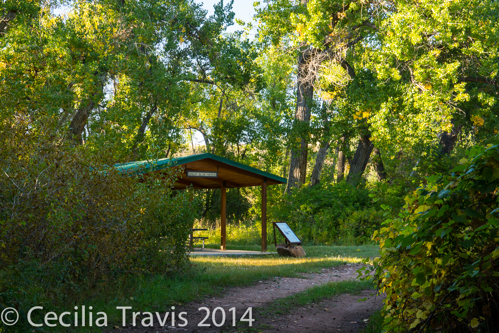
![]() Rebecca, who co-writes Just Trails, posted this list of wheelchair accessible trails near Laramie.
Rebecca, who co-writes Just Trails, posted this list of wheelchair accessible trails near Laramie.
Continental Divide Trail in CO
The Continental Divide Trail is an amazing 3,100 mile trek from Mexico to Canada.
![]() You can walk a tiny portion of this trail, walking northwest from Lobo Overlook (altitude 12,000′). We were there the first week of October and there was too much snow for hiking, but I was told at least 1/2 mile is easy walking. However, the first 1/4 mile is downhill, which means you are coming uphill on the return. The 3 mile road to Lobo Overlook is off the summit of Wolf Creek Pass. The view alone is worth the drive, even if you don’t walk the trail. Here is a description from Trails.com and another from AllTrails.
You can walk a tiny portion of this trail, walking northwest from Lobo Overlook (altitude 12,000′). We were there the first week of October and there was too much snow for hiking, but I was told at least 1/2 mile is easy walking. However, the first 1/4 mile is downhill, which means you are coming uphill on the return. The 3 mile road to Lobo Overlook is off the summit of Wolf Creek Pass. The view alone is worth the drive, even if you don’t walk the trail. Here is a description from Trails.com and another from AllTrails.
Rails-to-Trails – Colorado
The Rails-to-Trails Conservancy lists wheelchair accessible trails in Colorado.
ORIC
ORIC has a comprehensive review of outdoor activities in Colorado, some of which are for the disabled. I believe I have links to information they give for the latter, but the website is definitely worth a visit.
Accessible Denver
Accessible Denver is a website which claims to be ” your source for disability-related information for those living in Denver or visiting the mile high city. Use the Resource Guide below to find medical services, businesses and professionals who provide information and assistance to the disabled community.” Not much here that pertains to this website.
National Sports Center for the Disabled
The National Sports Center for the Disabled has a hiking program called Summit Colorado. From their site: “Meet on Wednesday evenings to hike different trails around the Metro area. Once a month, join us on a day hike summiting one of Colorado’s majestic peaks.”
The Colorado Trail
The Colorado Trail
Most of the 500 mile Colorado Trail, which goes from Denver to Durango, is not accessible. However, there are a few places where you can follow it for short distances, at least on foot. Here is their website.
![]() The start of the Colorado Trail is at Waterton Canyon, a wide dirt road beside the South Platte River. Here is another link, and still another. I believe the first 6 miles are wheelchair accessible and there is an accessible fishing pier about a mile and a half from the parking lot. This is a road, not a trail, and you will meet a lot of bicyclists and runners, occasional cars and rattlesnakes. It can be very hot in the sun.
The start of the Colorado Trail is at Waterton Canyon, a wide dirt road beside the South Platte River. Here is another link, and still another. I believe the first 6 miles are wheelchair accessible and there is an accessible fishing pier about a mile and a half from the parking lot. This is a road, not a trail, and you will meet a lot of bicyclists and runners, occasional cars and rattlesnakes. It can be very hot in the sun.
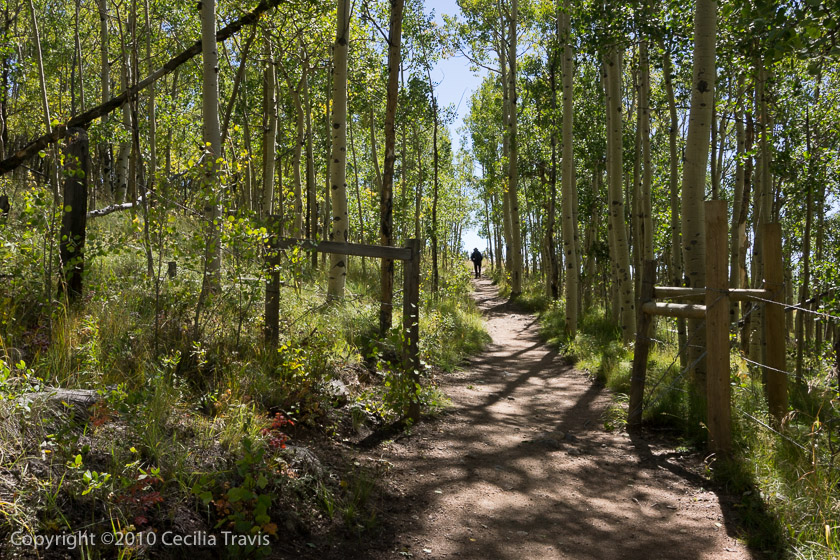
![]() We walked about 1/2 mile east on the Colorado Trail from Kenosha Pass. We could have gone farther as it was easy walking, but the way was blocked by two fallen trees. This is a convenient place to enjoy the aspen colors in the fall. Parking lot: N39° 24.814′ W105° 45.277′ The trail going west from the highway becomes difficult almost immediately.
We walked about 1/2 mile east on the Colorado Trail from Kenosha Pass. We could have gone farther as it was easy walking, but the way was blocked by two fallen trees. This is a convenient place to enjoy the aspen colors in the fall. Parking lot: N39° 24.814′ W105° 45.277′ The trail going west from the highway becomes difficult almost immediately.
![]() Another place to access the Colorado Trail is from the summit of Marshall Pass. It is easy walking for at least 1/2 mile going North from the summit.
Another place to access the Colorado Trail is from the summit of Marshall Pass. It is easy walking for at least 1/2 mile going North from the summit.