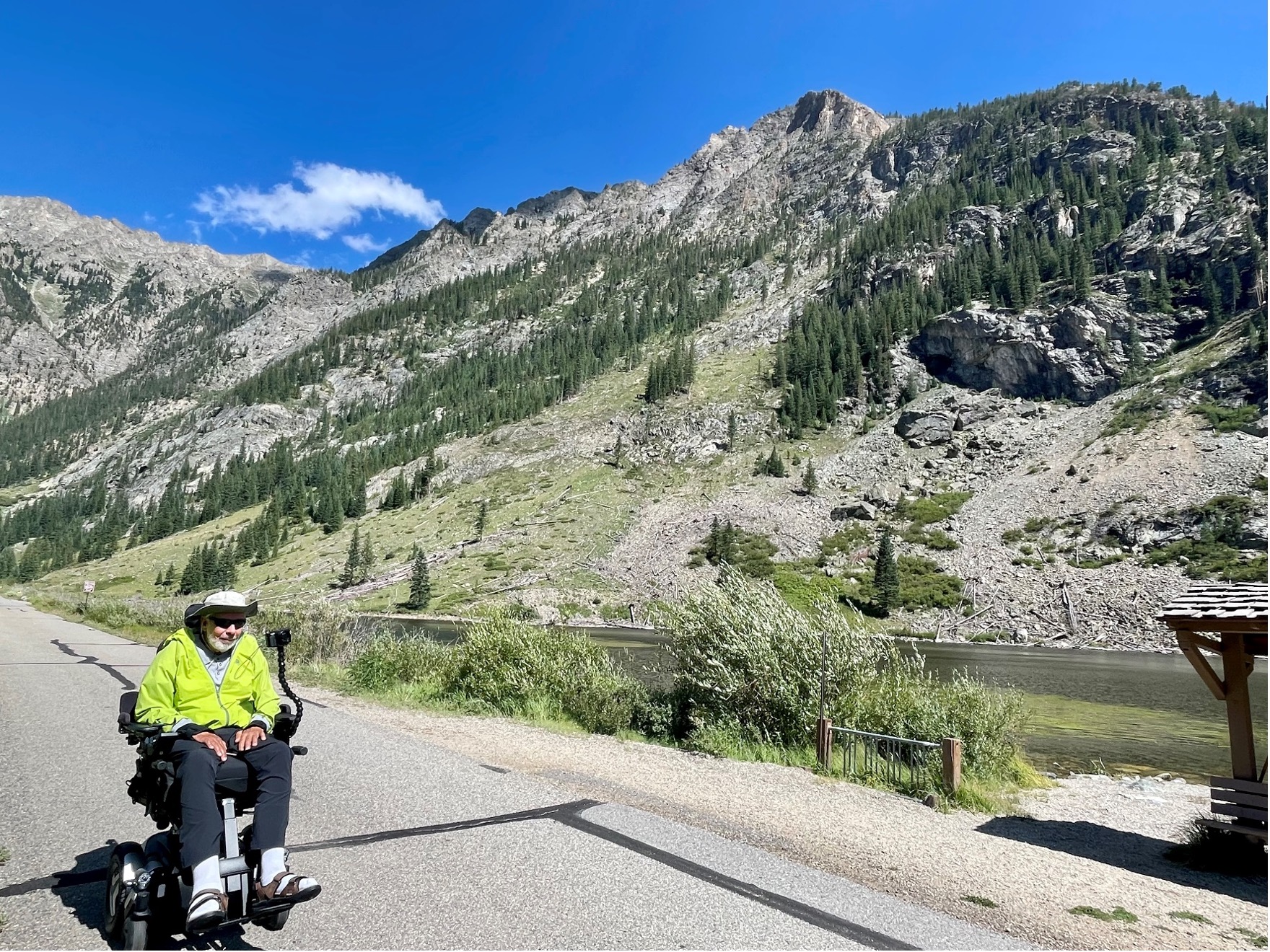
Colorado has a number of trails with minimal obstacles in natural areas. Some are very easy and others are wheelchair accessible. Here are a few of them.
Most of the links given were found through Internet search. Some places I have been able to visit and a few have been recommended to me by other people who have been there. With your help, we can share our knowledge with disabled people everywhere and also increase awareness of the need for more accessibility. Please e-mail me with your suggestions using the form in the sidebar.
Federal
State
Local
Private
Miscellaneous
Federal
Arapaho & Roosevelt National Forests
These mountain Forests in north central Colorado include popular destinations such as Guanella Pass, Alpine Central Railroad Grade trail, Brainard Lake Recreation Area and the Mount Goliath Natural Area.
Supervisor’s Office 970-295-6600. The National Forests website. Links to Maps
 Brainard Lake Recreation Area Although trails leading from Brainard Lake are not particularly easy, you can enjoy walking around the lake’s margins. Watch out for moose! Here is their website.
 Alpine Central Railroad Grade As long as you want to do, but 3 miles to Pavilion Point. The trail starts at Silver Plume and goes 13 miles to Mt. McClellan. Here it is described by the Hiking Project.
 Guanella Pass Most of the trails from the top of Guanella Pass are too long and steep in places to be included here. However, it is an easy drive from Georgetown to the parking lots at this above-timberline destination, There are flowers and beautiful views and a toilet! Here is a description of some trails that lead off of the pass. And another website about the pass area.
 Rainbow Lakes Trail c 2.6 miles round trip along a series of 9 small lakes and beaver ponds. Said to be easy but rocky in places. Another place to watch out for moose. It is north of Nederland. Phone 303-541-2500. Reviewed by AllTrails. Here is the Forest Service’s description and directions, but they have accidentally included it in the webpages for Lincoln National Forest in New Mexico.
Look farther down this Federal section to see listings specifically for Roosevelt National Forest and the Pawnee National Grasslands.
Arapaho & Roosevelt National Forests – Mount Goliath
Mount Goliath is a beautiful area right at timberline on the road towards Summit Lake. The area immediately around the Nature center is accessible and the close by trails are easy walking. Mt. Goliath is famous for its ancient bristlecone pines and alpine garden. Interpretation displays and an accessible restroom are available in the Dos Chappell Nature Center. The garden is managed by the Denver Botanic Gardens in conjunction with the U.S. Forest Service. A call to the Clear Creek Ranger District 303-567-4382 will let you know if the road is open. Here is the website.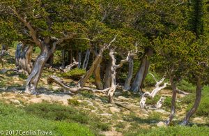
Bristlecone pines, Mt. Goliath area, Mt. Evans, Colorado 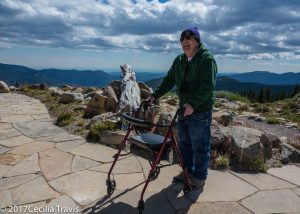
Photographer Jack Olson at Goliath Park on the Accessible patio at Dos Chappel Nature Center, Mt. Goliath, Arapahoe National Forest, Colorado  A limited area is wheelchair accessible. The path through the garden is easy.
Arapaho National Wildlife Refuge Complex in northern Colorado and southern Wyoming has an accessible trail and some ADA compliant overlooks. The Hutton Lake National Wildlife Refuge has an easy hiking trail. These refuges are part of a refuge complex that includes one refuge in Colorado and four in southern Wyoming. The headquarters are in Walden, Colorado. Phone 970-723-8528. Here is their website.
Arapaho National Wildlife Refuge is south of Walden, Colorado in North Park, an intermountain glacial basin with an elevation ranging from 8,100 to 8,700′.
Phone 970-723-8202
 Moose-Goose Nature Trail 0.5 mile “…winds along the Illinois River, provides a great chance to view song birds and other riparian residents.”
There are three ADA compliant overlooks and an accessible viewing blind.
Hutton Lake National Wildlife Refuge
 2.6 miles of hiking trail. “It is possible to hike all or portions of the system. The flat to gently sloping terrain makes it enjoyable for all hikers.” Here is the website for Hutton Lake.
Comanche National Grasslands – Vogel Canyon
Vogel Canyon, a tributary of the Purgatorie River Drainage, has the easy Overlook trail and three other hiking trails going to the canyon bottom or along the mesa top. There are two permanent springs located at the bottom of the canyon, which support a variety of wildlife. American Indians lived in the canyon 300 – 800 years ago and left rock art which is visible on the canyon walls.
Here is the Forest Service Website and another website with lots of information.
 “The Overlook Trail is a one mile round trip. This trail is handicapped accessible and consists of a gravel walkway along the top of canyon.” the trail goes through shortgrass prairie and juniper trees and ends at the top of a small cliff with a view of the canyon. Here is a trail description from All Trails.
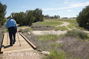
Wheelchair accessible Overlook Trail to Vogel Canyon, Comanche National Grasslands 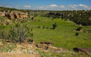
Vogel Canyon from wheelchair accessible Overlook Trail, Comanche National Grasslands, CO Dinosaur National Monument
Dinosaur National Monument has one wheelchair accessible trail and numerous easy trails. The monument lies on the border between Colorado and Utah at the confluence of the Green and Yampa Rivers. just to the north of the town of Vernal, Utah. There are over 800 paleontological sites in the Jurassic Morrison formation. There are fossils of many dinosaurs including Allosaurus, Deinonychus, and Abydosaurus. Dinosaur National Monument protects 105 miles of the Green and Yampa rivers and more than 210,000 acres of the rivers’ canyons.
Phone 435-781-7700 Map Accessibility Links to trail details Monument website
 Plug Hat Trail 0.25 mile loop paved “…trail on top of a butte affords excellent views of the surrounding landscape and provides an introduction to the pinyon pine-juniper community.”
 Cold Desert Trail 0.5 mile loop “This short, level walk provides insight into the diversity of the desert shrub community found around Dinosaur National Monument.”
 Box Canyon Trail 0.5 mile in and out. “A level walk into a shady box canyon.”
 Gates of Lodore Trail 0.75 mile one way. There are a “few steps” at the beginning of the trail and then it is a level walk above the Green River ending at a view of the entrance to Lodore Canyon.
 Hog Canyon Trail 1.5 mile one way. “A relatively level walk into a box canyon.”
 Florissant Fossil Beds National Monument
Florissant Fossil Beds National Monument preserves fossils from 34 million years ago at the site of the Eocene-era Lake Florissant, which was inundated with volcanic ash. The ash has preserved an amazing assortment of plants, fish, spiders, and insects whose fossil remains can be seen at the visitor center. You will also see huge petrified tree stumps. There are 14 miles of hiking trails there, most of them pretty easy and one fully accessible. Check with the Visitor Center to determine their condition and suitability for you.The Monument has a non-motorized wheelchair with large, inflatable tires that can be requested and borrowed for daily use.”
Here is their website. Accessibility Map of hiking trails. Phone 719-748-3253
 Ponderosa Loop Trail, 0.5 mile self-guided trail. It may be covered by snow in the winter.
 Petrified Forest Loops 1.0 mile self-guided.
Medicine Bow-Routt National Forests
From mountain ranges to grasslands and crystal clear streams, the national forests and national grassland provide abundant and unique opportunities for visitors.
Here is the Forests website. Phones: Forest supervisor 307-745-2300
From stateparks.com: “The Medicine Bow-Routt National Forests extend from north central Colorado to central Wyoming. The Forests encompass portions of many mountain ranges including the Gore Range, Flat Tops, Parks Range, Medicine Bow Mountains, Sierra Madre, and Laramie Range.”
Unfortunately, this branch of the Forest Service gives very little information on trails. Here is the page with links to information each trail, but they seldom give length, let alone difficulty rating.
Brush Creek/Hayden Ranger District 307-326-5258
Snowy Range Scenic Byway also described here
 Mirror Lake Picnic Ground includes an accessible path to the water, campsites and fishing platform.
 Lake Marie Trail goes along the southeast shore of the Lake
 Brooklyn Lake Road 3.5 miles described as easy in Hiking Project.
Douglas Ranger District 307-358-4690
Laramie Ranger District 307-745-2398
 Medicine Bow Trail is a 23 mile Rail-Trail from Laramie to Coalmont Colorado. Hiking Project description.
 This is some information about Pawnee Campgrounds
Pawnee National Grassland
The Pawnee National Grassland in northeast Weld County, Colorado is part of the Roosevelt National Forest and has the accessible Trail of the Mourning Dove and a Birdwalk in the Crow Valley Recreation Area. The grassland is a part of the short grass prairie and a fine location for spring wildflowers and for birding. Wildlife includes pronghorn, bison, prairie dogs and many others. The Buttes, which rise about 300 feet above the plains are erosional remnants of the High Plains. They consist of the soft clay-rich Brule formation overlain by the sandstone and conglomerates of the Pawnee Creek and the Arikaree formations.
Be sure to call ahead to learn of trail conditions and of seasonal closures. Here is the website. Phone 970-834-9270 Map
Crow Valley Recreation Area
 Trail of the Mourning Dove Short trail from the Steward J. Adams Education Site along the usually dry Crow Creek”
 Birdwalk Trail Short walk across a dry creek bed and into a cottonwood stand.
Pawnee Buttes Trail
 1.5 mile trail to the first butte and 2.1 mile to “slightly beyond the eastern base of the western Pawnee Butte. The trail is rated easy or “easy to intermediate” depending on which reference you find. Here is a detailed description. Call ahead to learn more.
Rio Grande National Forest
The Rio Grande National Forest in south central Colorado includes the spectacularly beautiful San Juan and Sangre de Cristo Mountains and contains the San Luis Valley and parts of four wilderness areas. There is not much online about easy trails here, so please write me about your favorites.
 Big Meadows Reservoir Thank you to Ronnie Day of the Forest Service, who wrote: “Our terrain doesn’t allow for much but we have a place called big meadows reservoir that has a short hardened trail from the campground down to the lake shore and along the shore a short ways. The rest of the trail circles the lake and is fairly easy along the dam and up the north shore. ” There is a wheelchair accessible fishing pier. Here is a link to a description of the Big Meadows Reservoir area.
 The Alder Bench trail (Forest Service trail 799) is easy for the first half mile or so going up into the forest. We stopped where it turned back and steepened. Directions and map. Coming back down to the trail marker post (it has lost its arms) I then followed a social trail north paralleling Alder Creek. After about 1/2 mile barbed wire marks the start of private property. This was a lovely, quiet little walk. Very easy and pretty.
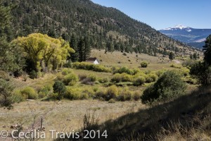
View of Alder Guard Station from the start of easy lower part of Alder Bench NFS trail #799 Rio Grande National Forest CO 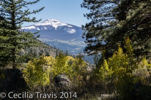
Del Norte Peak seen from easy lower part of Alder Bench Trail, NFS #799 Rio Grande National Forest, CO Rocky Mountain Arsenal National Wildlife Refuge
The Rocky Mountain Arsenal northeast of Denver, Colorado occupies more than 15,000 acres and has many easy hiking trails and a self-guided Wildlife Drive auto tour. Visitor activities include wildlife observation, photography, environmental education, nature programs, and fishing. You may see over 330 species of wildlife there. Trails and Wildlife Tour map Although I have been told there are ADA-compliant trails there, the brochure only gives the lengths of the many short trails. Location map
The Arsenal’s website. The Visitor Center phone is 303-289-0930Rocky Mountain National Park
Rocky Mountain National Park’s accessible trails include Lily Lake Trail, Sprague Lake Trail, Bear Lake Trail, Coyote Valley Trail and the Holzwarth Historic Site Access Road. There is also a paved trail to the Forest Canyon Overlook. This high altitude park is 415 square miles of beautiful mountain country, easily reached from the northern Front Range Cities. Stop by a Visitor Center to learn about easy trails that might work for you. Phone 970-586-1206 Park Brochure Park Website Description in The Disabled Traveler’s Companion. Accessibility page from the Park Service.
Wheelchair Accessible Trails described by RockyMountainNationalPark.com This web site is not affiliated with the National Park Service or National Forest Service, but looks pretty useful. They also have information on Roosevelt and Arapaho National Forests and the neighboring communities of Estes Park and Grand Lake.
The drive over Trail Ridge Road goes above timberline to 12,000′ altitude giving you a chance to experience the tundra and distant mountain views without needing to hike. However, even walking may leave you short of breath at this altitude. Sprague Lake 0.75 mile around the lake. There is a striking view of the Rampart to the west.
  This trail is open in the winter and the snow is usually packed down so you can walk it using poles and with spiked treads attached to your boots. For those of use who can’t ski anymore it is wonderful to get out and experience some winter.
 Bear Lake 0.89 mile loop around popular Bear Lake.
 Coyote Valley 1 mile round trip in the Kawuneeche Valley, downstream from the Colorado River’s headwaters in the Never Summer Mountains.
 Lily Lake Trail 0.8 mile – a pretty loop around the lake. You can reach it off of highway 7 south of Estes Park and although it is administered by the Park Service, there is no fee.
GPS at parking lot N40° 18.404′ W105° 32.270′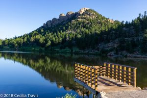
Lily Lake and ADA wheelchair accessible fishing pier, Rocky Mt. National Park, CO 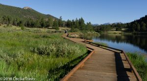
Wheelchair accessible trail around Lily Lake, Rocky Mt. National Park, Colorado  Forest Canyon Overlook in Rocky Mountain National Park is fully wheelchair accessible and has beautiful views of the canyon below and Longs Peak in the distance. GPS at parking lot N40° 23.731′ W105° 12.691. Trail Ridge Road is closed in winter and early spring.
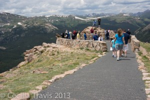
Wheelchair accessible Forest Canyon Overlook, Rocky Mt. National Park, Colorado Altitude about 11,700 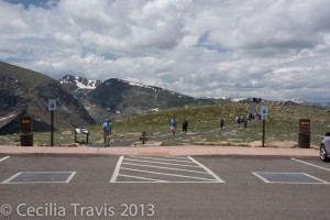
Parking space at Forest Canyon Overlook, Trail Ridge Road, Rocky Mt. Nat’l Park Roosevelt National Forest
The Canyon Lakes Ranger District of the Roosevelt National Forest in north central Colorado includes the Pawnee National Grasslands, Pingree Park, the Red Feather Lakes area and Big Thompson and Estes Park. The Poudre Wilderness Volunteers post an informative website describing these areas. Phone for the Canyon Lakes Ranger District is 970-295-6700.
Pawnee National Grasslands I have a separate post about this area. Look for it above this post.
Pingree Park contains Colorado State University’s Mountain Campus. Map
 Comanche Lake 1.1 miles to the lake, 1.6 miles if you go around the lake. Here is a detailed description of the trail.
Red Feather Lakes
 Lady Moon Trail is 2.6 miles between the two trailheads, but you may just want to hike a mile or mile and a half from the Elkhorn Creek Trailhead. Half a mile from the Lady Moon trailhead and about 1.5 miles from the Elkhorn Creek trailhead the trail takes an elevation gain which may be more strenuous than you want. Here is a description.
 Mt. Margaret Trail 3.8 miles downhill! to the summit You may want to just hike the first 1.5 miles to avoid an uphill return. Most of this trail is on an old roadbed . Forest Service description. Location Map Described on AllTrails and on HikingProject.
You can gain access to the easy-sounding Columbine Trail Complex from the Mt. Margaret trail, but that is probably a longer hike than you want to take. These trails are also mostly old roads.
Here is a map of the Red Feather Lakes area.
Lily Mountain
 Lily Mountain Trail is pretty level for the first mile before climbing over 800′ to the summit in just one more mile. Description Road map showing the trailhead.
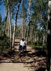
Big Al Trail ©Jack Olson San Juan National Forest
The San Juan National Forest has the wheelchair accessible Big Al trail and a short paved trail at Animas Overlook as well as accessible fishing at Andrews Lake. The Forest occupies 1.8 million acres of high alpine peaks and meadows to desert mesas in southwest Colorado. This beautiful area includes the South San Juan, Hermosa, Weminuche and Lizard Head Wilderness areas. Phone 970-247-4874
Here is their website.
Thank you to Jack Olson and to Mark Winkworth for the following information:
 Big Al Trail 0.5 mile “surfaced, barrier-free trail leading…to a deck overhanging West Mancos Canyon. Interpretive signs point out flora and fauna, and there are benches for resting. The trailhead is across from the campground entrance.” From World Travel Blog (which includes directions to the trailhead): The trail “provides spectacular views of the west Mancos Canyon within the La Plata Mountains. With a total ascent of 53 feet over a half mile, this hike can be completed by anyone, including those in wheelchairs.”
 Animas Overlook Trail a “short paved but rough trail” in the area of a good picnic spot up the Junction Creek Road overlooking the north Animas Valley.
Mark Winkworth writes that there is accessible fishing at Andrew’s Lake.
Two Ponds National Wildlife Refuge
 The refuge is divided into two areas, both of which have accessible trails. The Prairie Management Area is open dawn to dusk all year. We went in October and were disappointed to learn that the more interesting Two Ponds area is only open May through September and then only Tuesdays through Saturdays from 8:00 a.m. to 4:00 p.m. Dogs are not allowed on the refuge. Described on National Recreational Trails site. Reviewed on Trip Advisor
Map Phone 303-289-0232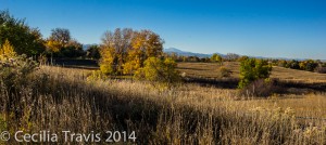
View from Prairie Management area of Two Ponds NWR 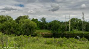
Two Ponds National Wildlife Refuge, Arvada CO 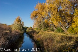
The Highline Canal crosses Two Ponds NWR White River National Forest
“White River National Forest is the most visited national forest in the nation encompassing 2.3 million acres. With 11 ski resorts, eight Wilderness areas, 10 mountain peaks over 14,000 feet and 2,500 miles of trails, this forest is a place where you can press play on adventure and inspiration!” Here is the Forest website. Phone for the Forest Supervisor’s Office in Glenwood Springs is 970-945-2521.Tenmile Canyon National Recreation Trail at Black Lake Number One
Thanks to Bob King who provided all the following information and photographs:
The Tenmile National Recreation Trail, is paved and extends for 18 miles, connecting to other paved trails. It passes by Black Lake, altitude about 10,500″. The lake is a beautiful spot with a fishing pier and quite a few wildflowers. We’ve also seen Bald Eagles flying above the trees. Watch for bicyclists and stay on the right-hand side of the path Weekdays and late summer after schools are in session are less crowded times to go.
We park in a gravel lot below the dam…. There is no handicapped parking designation and there is a little lip up from the gravel lot onto the trail. We get to this spot from the Vail Pass exit off I 70 and then take the frontage road short distance to Black Lake. There are two other parking areas, but this is the safest place for wheelchairs, next to the gate that restricts car traffic. There is also a picnic area here. More information.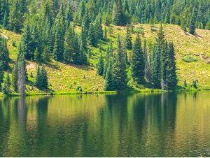
Reflections from evergreens across the lake. © Robert King 2021 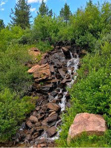
A small waterfall along the shared path. ©Robert King 2021 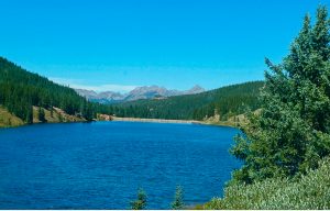
View of the surrounding forest and mountains looking north across Black Lake showing the dam and a bit of the trail on the right/east side. © Robert King 2021 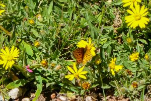
Butterfly on a golden aster near the lake. © Robert King 2021
State
There are about 42 State Parks in Colorado. Admission for a day is $7 per vehicle or $70 a year ($60 for seniors). There is no charge for vehicles bearing a disabled veteran’s plate. Disabled visitors may apply for a yearly $14 Columbine Pass, which can be transferred between cars.
Arkansas Headwaters Recreation Area
The AHRA has a variety of trails for outdoor recreation.
 Hayden Meadows “at the northern end of AHRA, has ADA accessible interpretive and fishing trails, 5 wetland boardwalks, and 2 bridges surrounding a small reservoir.”
Phone 719-539-7289 Map & Brochure
Barr Lake State Park
Barr Lake State Park surrounds a 1900 acre reservoir ringed with Cottonwoods, marshes and aquatic plants. It is a favorite with the birding community.
You can ride their “Eagle Express” (like a golf cart seating 14) for a naturalist guided tour. It is available in warm weather on weekends. Call 303-659-6005 for information.
Here is the Park website. Phone 303-655-1495 or 303-659-6005 Trails Brochure and Map
 ? Although the road around the 9 mile perimeter of the lake is not officially ADA compliant, it is a hard pack dirt and small gravel road and outside of serious mud and snow times shouldn’t pose a problem. From the Nature Center to a Gazebo reached by a boardwalk over the water is 1.2 miles. In fair weather this includes a spectacular view of the Front Range, but even on a poor day, the lake, waterfowl and old cottonwoods make a pretty walk. There is an accessible blind for wildlife observation.
 Niedrach NatureTrail is partly boardwalk, and once current improvements are made, may also become wheelchair accessible, although it is a little narrow in places.
 Fox Meadows Trail is easy walking, but includes a few steps.
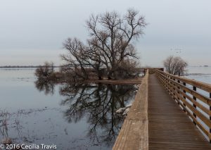
Boardwalk to Waterfowl Observation Point, Barr Lake State Park 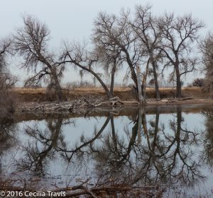
Barr Lake Reservoir, Barr Lake State Park Castlewood Canyon State Park
Castlewood Canyon State Park near Franktown, Colorado has wheelchair accessible trails as well as more difficult hikes into the canyon. The park is the site of the Castlewood Dam which burst in 1933, sending the waters of Cherry Creek into Denver in a 15′ wave. Leashed pets are welcome on most trails. The east side, where the Visitor Center is, has two concrete-paved trails, picnic tables, an amphitheater, and an easy walking trail. Here is their website. Trails Map Phone 303-688-5242 The Canyon View Nature Walk is 1.2 miles between parking lots and is ADA accessible.
 The Bridge Canyon Overlook trail is 400 ft one way.
 The first few hundred feet of so of the Lake Gulch trail, leading north from the parking lot has spectacular views of Pikes Peak. Eventually it drops down in a set of difficult steps.
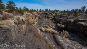
View from Bridge Canyon Overlook, Castlewood Canyon State Park 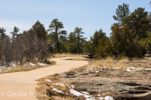
Wheelchair accessible Canyon View Trail, Castlewood Canyon State Park Chatfield State Park
This state park surrounds Chatfield Reservoir, southwest of Denver. Together they comprise 3,895 acres of water and mostly flat land. Recreational activities here include hiking, horseback riding, fishing, boating, swimming and camping. Chatfield is a good place for birding. Wildlife includes muskrat, coyote, foxes, white-tailed deer and bear.
Phone 303-791-7275 Park website Trails Trail Map Park Brochure
 The Chatfield Internal Trails network is 10 miles of ADA accessible paved trail. The Chatfield Dam Trail is 2.4 miles of ADA accessible asphalt.
Eldorado State Park
Eldorado State Park, near Boulder west of highway 93 is a day use park which offers hiking between sandstone cliffs, picnicking along along South Boulder Creek and views of climbers on spectacular rock exposures. GPS at entrance station: N39° 55.923 W105° 16.839.
Here is their website. Phone 303-494-3943 Trails Map and Brochure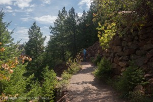
Wheelchair accessible Fowler Trail, Eldorado State Park CO  The Fowler Trail is a self-guided nature walk built for wheelchair use. There is one rather narrow spot, but I was assured that people negotiate it without problems. It is about 1/2 a mile long and has great views. Bring your own binoculars as the two telescopes set up for viewing raptors (or climbers) on the other side of South Boulder Creek are too high for viewing from a wheelchair.
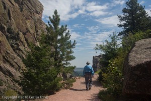
Looking east from wheelchair accessible Fowler Trail, Eldorado State Park CO 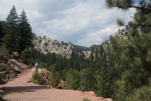
Wheelchair accessible Fowler Trail, Eldorado State Park CO Mueller State Park Phone 719-687-2366 Short Trails for the Family Trails Map

From easy hiking Wapiti Trail Mueller State Park, CO 
From easy Wapiti Trail, Mueller State park  Dragonfly Loop 0.20 mile a very short paved trail, but a pretty spot good for fishing, birding, wildlife and flowers.
There is some elevation loss/gain on all these next trails. Check with the Visitor Center to see if they are easy enough for you.
 School Pond Trail 1.61 mile wide and gentle
 Elk Meadow Loop 2.38 miles
 Wapiti Trail 0.8 mile self-guiding nature trail which drops drops down about 200′ before climbing back up. There are 3 granite steps at the bottom which you can bypass without too much difficulty. Be sure to use your trekking poles.
Ridgeway State Park Phone 970-626-5822 Trails Map Brochure and Trails Map
 Mear’s Bay Trail 1.0 mile concrete trail that “winds along the shoreline of Mear’s Bay in the Dutch Charlie area. Waterfowl such as Western grebe, Canada geese and great blue heron can be seen here during the more quiet hours of the day. Enjoy beautiful views of the San Juan Mountains reflected in the bay.”
 Marmot Run Trail 1.8 mile that “runs along the east shore of the Uncompahgre River and the Ridgway Reservoir.”
 River Walk 0.2 mile runs along the Uncompahgre River
 ? Forest Discovery Trail 0.6 mile is a steep, up to 12% grade, self-guided nature walk, but has a “compacted – firm” surface with no obstacles. It is next to the Dutch Charlie Visitors Center, so you could ask there about difficulty.
 Roxborough State Park
This beautiful park near Denver is a designated National Natural Landmark. “The park, with close to 4000-acres, is filled with dramatic red-rock formations, distinct plant communities, and a host of wildlife ranging from black bears to mule deer.” There are accessible restrooms and a visitor center. The park is day use only. Phone 303-973-3959 Here is the park website. Trails Brochure and Trail Map ? The Fountain Valley Trail is basically a 2.3 mile dirt road and can be wheelchair accessible with assistance during dry seasons. There may be some erosion in places, so be sure to call ahead. It does not qualify for ADA designation.
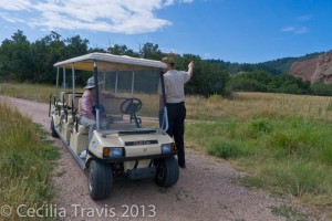
The Roxborough Ride gives disabled visitors a naturalist-led tour of the Fountain Valley Trail. You can ride this trail in the “Roxborough Ride”, a golf cart seating 6 guests and a volunteer driver/naturalist guide. Although the Ride is free, donations are requested. Each disabled person must be accompanied by an able person to help them on and off the cart. The ride is usually scheduled for Saturdays and Sundays and reservations are wise. Call the park, 303-973-3959, for more information.
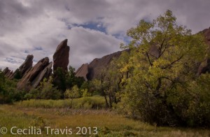
Fountain Valley Trail, wheelchair-accessible-with-assistance. Roxborough State Park CO  Although the shorter Willow Creek trail is not wheelchair accessible, I have done it with a walker. Roxborough is truly beautiful and surprisingly peaceful, given its proximity to Denver.
Staunton State Park phone 303-816-0912
Staunton State Park, north of US285 near Shaffer’s Crossing, is the most recently opened of Colorado’s state parks. The park features high grassy meadows at 8,100 feet in altitude to granite cliffs over 10,000 feet. “Staunton State Park’s varied geology, soils, water features, and climate support rare and unexpected plant communities and a rich diversity of wildlife…”
Although not listed as “accessible” several of the trails are smooth and easy. We walked just the lower first 2 miles of the Staunton Ranch trail, which meant a 4 mile round trip and my (then) 88 year old husband had no problem with it. Here is the Park’s website. There is a 20′ by 12′ ADA access fishing pier at the Davis Ponds. AllTrails’ description Park Brochure Trail Map Leashed pets are allowed.
 A wonderful new development at Staunton is their motorized track chair. Call ahead to reserve the chair, which can be used on 10-15 miles of trail within the park. There is no extra charge other than the park’s pass required of everyone.
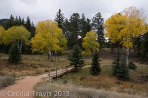
Easy Davis Ponds Loop Trail, Staunton State Park 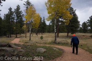
Easy Davis Ponds Loop Trail, Staunton State Park  Davis Ponds Loop trail 2.3 miles is easy and has been recently improved. There are a couple of places that might be a little steep without brakes, but I have seen steeper labeled “wheelchair accessible”.
Steamboat Lake State Park Phone 970-879-3922 Trails Map and Brochure
 Willow Creek Trail 3.8 miles total
 ? Tombstone Nature Trail is a self-guided interpretive trail described on the park’s website as 1.1 mile and easy to moderate. Trails.com describes it as 0.75 miles and easy. The trail has its own Facebook page.
Local
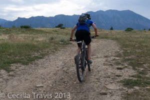
Bicyclist on rough patch of Marshall Mesa Trail Boulder Open Space The city of Boulder has a great web page devoted to accessible trails. There is also an amazing online book with detailed descriptions of Accessible Trails & Natural Sites in the Boulder area. The floods of 2013 severely damaged many of the trails. Check with Boulder Open Space for trail conditions.

Marshall Mesa Trail Boulder describes this trail as “appropriate for wheelchair users who are looking for an extra challenge”. I should say so. I watched a boy of about 10 who was having difficulty bicycling up the short rough stretch that is about 13% grade.
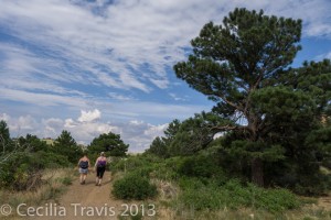
Hikers on partly wheelchair accessible Marshal Mesa Loop Trail, Boulder Co. Open Space, between Golden and Boulder, Colorado 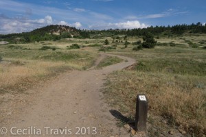
Wheelchair accessible crossing at ditch on Marshall Mesa Trail, Boulder Open Space, Colorado Walden Ponds is at 75th St. between Valmont and Jay Roads. The reclaimed gravel pits are a great place for viewing waterfowl. The 2.9 miles of flat dirt trails connect to the also very easy Sawhill Ponds trails. There is a wheelchair accessible boardwalk, a picnic table, and a fishing pier. When dry, most of the trails appear to be wheelchair accessible.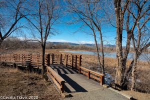
Wheelchair accessible boardwalk into marsh at Walden Ponds, Boulder Open Space, Colorado 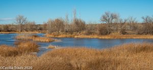
Walden Ponds from accessible trail 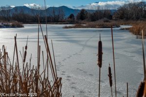
Animal tracks on ice at Walden Ponds, Boulder Open Space, Colorado City of Fort Collins
Fort Collins has a lot natural areas, many of them with paved or easy trails.
 Fossil Creek Trail 5.17 miles paved. “…runs through the Cathy Fromme Prairie Natural Area along Fossil Creek. It extends west and north to meet the Spring Creek Trail at Spring Canyon Park.”
 Poudre Trail 12.3 miles paved. From traillink.com “…follows the meandering course of the Poudre River from the Bellevue Watson Fish Hatchery to Colorado State University’s Environmental Learning Center on East Drake. The trail passes through wooded corridors and among agricultural and natural areas, small lakes and holding ponds, parks and light industrial sites.” Natural Areas crossed or bordered by the Poudre Trail include Butterfly Woods , Gustav Swanson, Homestead, Willams, Springer, Riverbend Ponds, Kingfisher Point, Cattail Chorus, Prospect Ponds, and Arapahoe Bend.
 Arapaho Bend Natural Area Map “About 4 miles of natural surface and paved trail follow the edge of the ponds in a loop and encircle Rigden Reservoir.”
 North Shields Ponds Map “1.5 miles of natural surface trail, wheelchair accessible fishing deck…”
 Coyote Ridge Natural Area “The Hidden Clues Trail is a 1/4 mile interpretive loop located about 1 mile into the site. The interpretive loop is wheelchair accessible. The City will make arrangements for groups of persons with limited mobility to have vehicle access to the accessible trail loop. Call 970-416-2815 or email…”
 Fischer Natural Area 0.3 mile of the paved Spring Creek Trail
 Fossil Creek Reservoir Natural Area Heron Loop 0.25, Trail Map
 ? Magpie Meander Natural Area Map 0.16 miles of natural surface trail looks as if it is accessible. There is an accessible fishing pier.
 Mallards Nest Natural Area 0.4 mil of Spring Creek Trail
 Pelican Marsh Natural Area Map “There is about 1 mile of flat trail including a paved trail connecting Water’s Way Park to Carpenter Road, a gravel trail along Carpenter Road and a paved trail from Water’s Way Park to a wildlife viewing area of Robert Benson Reservoir.”
 Pineridge Natural Area 1.8 mile soft surface loop round Dixon Reservoir.
 Red Fox Meadows Natural Area
Map 1 mile of flat soft surface
 Reservoir Ridge Natural Area Map The Parking lot at Overland Trail Rd is at start of an “easy flat trail” 1.4 miles.
 Riverbend Ponds Natural Area Map In addition to the Poudre Trail, there are “About three miles of natural surface trails and a boardwalk from the Cherly St. entrance.”
 Ross Natural Area 0.7 mile of paved Spring Creek Trail goes through this area.
 Salyer Natural Area Map 0.3 mile paved and 0.3 miles natural surface.
 Soapstone Prairie Natural Area Map Brochure
Lindenmeier Overlook trail 0.25 paved to pavillion with interpretive signs.
 The Coterie Natural Area 0.1 mile of the paved Spring Creek Trail
 Two Creeks Natural Area 0.2 mile paved. Nearest parking is in Fossil Creek Park 5821 S. Lemay Ave.
Map of Wheelchair Accessible Trails Trails Map of Natural Areas
Parks 970-221-6660 Recreation 970-221-6655
Natural Areas 970-416-2815 Rangers 970-416-2147
City of Georgetown

 ? The Bennhoff Lake Trail circumnavigates Georgetown Lake. Thank you to the local resident who brought this lovely trail to my attention. “There is a 1.4 mile trail around Georgetown Lake that is flat, wide and paved with crushed gravel. There is no erosion. There is one little steep spot next to the dam. There is also an accessible platform for fishing. One side is next to the highway, but on the other side you can pretend it’s not there.” Here is a description from UncoverColorado.
Georgetown makes no claims that this trail is wheelchair accessible. However the surface is perfect and there are only two short rises. I have seen steeper trails than this labeled wheelchair accessible.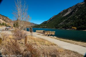
Wheelchair accessible Fishing Pier on the Bennhoff Trail around Georgetown Lake, CO 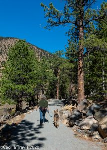
Hiker and companion walking the accessible Bennhoff Trail around Georgetown Lake, CO 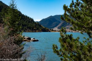
View from the Bennhoff Trail around Georgetown Lake, CO 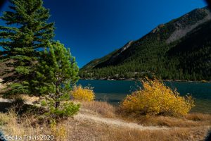
Side trail by the Bennhoff Trail, Georgetown Lake CO City of Golden
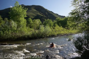
Kayakers seen from Accessible Clear Creek Trail, Golden CO  The city of Golden and Jefferson County Open Space have combined efforts and have made the path beside Clear Creek wheelchair accessible from Lyons Park to trail’s end, about a mile to the west. Between Lyons Park and the overhead Highway US6, the trail is concrete. West from the bridge, it has been filled in and covered with crusher fines. The concrete part is very busy, but can be entertaining as it overlooks the kayakers’ whitewater park. You will meet runners, dog-walkers, bikers, etc., but it is still a lovely path right beside the creek. This is a fair weather trail as snow and ice or heavy rains can render it difficult. In hot weather it can get too crowded with families coming to play in the cold water.
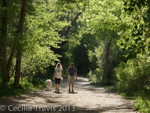
Wheelchair-accessible-with-assistance Clear Creek Trail, Golden CO 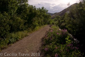
Trail along the irrigation ditch above Clear Creek trail. Accessible, but not a loop. 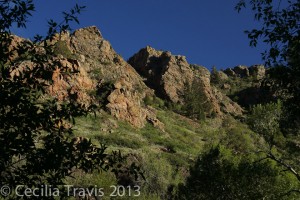
Rocks above Clear Creek Canyon, seen from end of Clear Creek Trail, Golden CO. 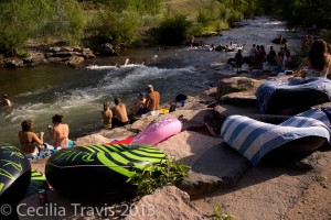
Summer crowd by Clear Creek, Golden City of Lakewood
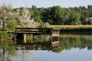
Lake from accessible trail at Bear Creek Greenbelt, Lakewood  The stretch of Bear Creek Trail that goes east/west from Estes to Wadsworth, south of Yale Ave. is part of the Bear Creek Greenbelt and is one of our favorite urban trails. There are two little lakes and lovely streamside stretches. It is pretty much all easy and a lot of it is wheel chair accessible. There are beaver, muskrat, coyote, prairie dogs, occasional deer and lots of birds. The toilet is being remodeled, but they have an accessible port-o-potty.
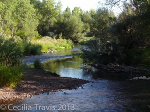
Bear Creek in Bear Creek Greenbelt, Lakewood 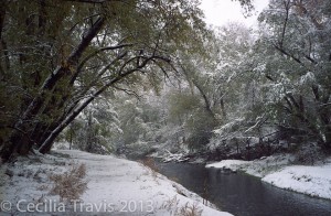
Fresh snow on easy walking trail Bear Creek Greenbelt, Lakewood CO City of Wheat Ridge

The Clear Creek Trail is flat and accessible as it runs along the creek 1.5 miles from Youngfield and 41st to just west of Kipling and 41st. There are benches and picnic shelters. We saw a coyote, a great blue heron, and beaver sign.
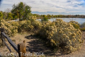
West Lake from the accessible Clear Creek Trail, Wheat Ridge, CO 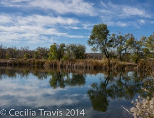
Bass Lake from the accessible Clear Creek Trail, Wheat Ridge, CO Colorado Riverfront Trail
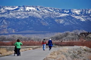
Colorado Riverfront Trail in Grand Junction. ©Bill Haggerty  The Colorado Riverfront Trail goes through Grand Junction and is planned to eventually span 21 miles along the Colorado (Grand) and Gunnison Rivers running from Fruita to Palisades and perhaps farther. It is a concrete, wheelchair-accessible trail with numerous access points. Maps of the trail and its segments are available on the website, linked above. Here is a pdf. of the index map. Thank you, Bill Haggerty, for telling me about the trail and providing the photograph.
Denver Mountain Parks and another smaller website on Denver Mountain Parks.
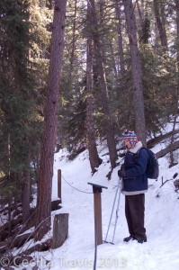
Chief Hosa Braille Trail, Colorado  Chief Hosa Braille Nature Trail is within Denver’s Genesee Park. Take I-70 west to exit 153 “Chief Hosa”. At the off-ramp stop sign, turn north, then turn right on to a dirt road -Stapleton Drive. Follow Stapleton Drive about 1 mile to the trailhead for the Braille Nature Trail. The trail has a vinyl-coated cable for guiding visually-impaired people. Metal interpretive signs along the trail in Braille and printed words explain the surrounding ecology. The signs are great, but some scumbag(s) have shot up some of them. The trail is about a third of a mile through forest and is not wheelchair accessible.
 The alpine trail between Summit Lake and the Chicago Lakes Overlook has just recently been redone to be wheelchair accessible. Summit Lake is about 12,800′ above sea level. The air is thin, temperatures are likely to be chilly, and it can snow anytime of year. It is also beautiful! GPS at parking lot: N39° 35.904 W105° 38.430.
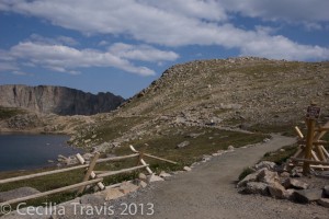
Accessible trail from Summit Lake to Chicago Lakes Overlook on Mount Evans CO 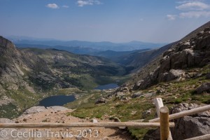
View of Chicago Lakes from wheelchair accessible trail at Summit Lake CO 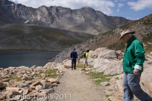
Accessible Trail from Summit Lake to Chicago Lakes Overlook  Echo Lake is another Denver Mountain Park. GPS for eastern (uphill) end: N39° 39.382 W105° 35.820. GPS for western (downhill) end: N39° 39.617 W105° 36.281. Although not signed as wheelchair accessible, the short trail between the Lodge and Echo Lake is a gentle downhill trip on crusher fines that takes you through the englemann spruce forest to the lake. There is parking at both ends of the trail, so someone could be dropped off at the top and join their group at the lake. It is not a loop trail.
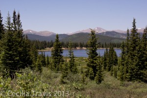
Looking west to Echo Lake 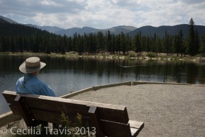
One of three accessible fishing platforms at Echo Lake, CO. 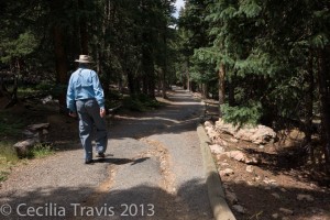
The only rough part of Echo Lake trail – a short eroded stretch on otherwise accessible trail. 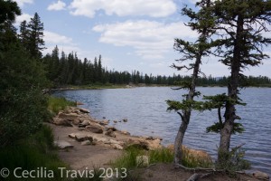
50′ west of the yellow rock is this pretty, accessible spur trail to the edge of Echo Lake  Columbine Open Space and Trail There are two 1.2 mile loops and the walking is pretty easy, but erosion makes the crusher fine trails doubtful for wheelchairs. The trails are close to traffic noise from I25.
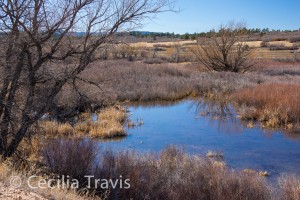
Wetlands seen from south loop trail, Columbine Open Space 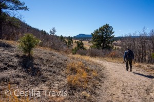
South loop trail, Columbine Open Space North Table Mountain This popular biking spot is one place where an electric wheelchair user might find it easier than a hiker. The flush toilets are ADA compliant, but the first .8 mile of trail is very steep. You might get away from the traffic noise once on top, but neither the signs nor brochure give you an idea of where best to go. ProTrails gives details of trail length and this Walk With Fred video is excellent.
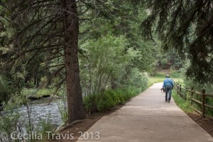
0.6 mile wheelchair accessible Pine Lake Trail at Pine Valley Ranch, Jefferson County Open Space CO  Pine Valley Ranch is highly accessible with fishing docks, a 0.6 mile wheelchair accessible trail around pretty Pine Lake and picnic shelters. The Narrow Gauge Trail runs beside the North Fork of the South Platte River and could be managed by wheelchair if Jeffco would cut the weeds growing in the middle of the trail.
 If you can hike without a walker, the very narrow, but level and easy North Fork view trail goes half a mile beyond Pine Lake to a bridge where you can come back on the Narrow Gauge Trail. Snow and ice cover the trails in winter and early spring. Parking lot: N39° 24.463′ W105° 20.825′.
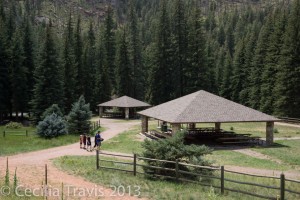
Accessible paths and picnic Shelters at Pine Valley Ranch Park 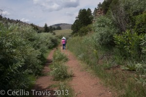
Weeds growing in Narrow Gauge trail at Pine Valley Ranch Park 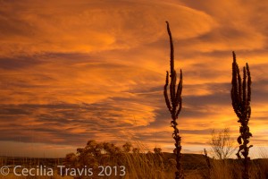
Mullein at sunset, easy trail at South Table Mt., Jefferson Co. Open Space, CO Unfortunately the regular closing of the access road from Quaker St. to the top of the mesa renders our favorite part inaccessible for wheelchairs.
 Hikers looking for an easy walk on the south side of the mesa can park in the small lot on Golden Hills Rd. a little west of Quaker Street. GPS: N39° 44.844′ W105° 11.031′ Walk north a short way and then take the narrow path to the east which goes to the dirt road. Staying on the road would take you to the State Patrol training area and some NREL property, but first you reach a wide, crusher fine-based foot and bicycle trail . This has the same panoramic views as North Table Mt., but without the traffic noise and fumes. You are likely to see deer and hear coyotes and meadow larks, but be watchful for rattlesnakes. It is a great place for sunsets. Addendum Sept, 2013: Jeffco Open Space is creating 3 miles of accessible trails on South Table Mt. Once it is done, I will change this entry.
Lair O’ The Bear Park from easy walking Creekside Trail, Jefferson Co. Open Space CO  Lair O’ The Bear is a small, lovely park by Bear Creek. There is a little noise from Highway 74, but it is pretty quiet in the middle of the week. The park has accessible toilets, picnic tables, and a fishing deck. The pretty Creekside Trail and part of the Bear Creek Trail are wheelchair accessible and easy walking. Dipper Bridge is now closed because of flood damage. The normally easy Bear Creek Trail going west from Dipper Bridge is often icy in winter. There is a new accessible fishing platform near Ouzel Bridge.
Here is a description with photos by Deb Stanley from Examiner.comLarimer County Parks & Open Space
Larimer County has 15 Reservoirs and Open Space Parks. Most of these have trails rated “easy”, but you should call to see if they are really easy enough for you. Recreation Map Phone 970-619-4570 Trails
Pinewood Reservoir County Park Brochure
 Poudre River Trail Phone 970-619-4534 “Once complete, the Poudre River Trail will be over 40 miles in length, from Bellvue, north of Fort Collins, to Island Grove Park in Greeley. The trail is currently in three sections separated by two gaps. An approximately 15-mile section is located in and managed by Fort Collins, a 1-mile section is in Timnath and a 21-mile section is located in unincorporated Larimer County, Windsor, Weld County and Greeley.”
 River Bluffs Open Space is crossed by about half a mile of the 21 mile paved Poudre River Trail
 Ramsay-Shockey Open Space 0.25 mile boardwalk starts at Pinewood Reservoir‘s Blue Mountain Campground. Brochure Map
Poudre River Trail
 The Poudre River Trail is a “… 21-mile long paved recreation trail that wanders alongside the majestic Cache la Poudre River from Greeley to Windsor in Weld County…” Website by poudretrail.org Phone 970-336-4044 Map Trailheads between Greeley and Windsor
South Suburban Parks and Recreation
South Platte Park, Littleton – This riverside park has lots to offer the disabled nature lover.
The paved Mary Carter Greenway multi-use trail runs 8 miles along the South Platte River. Parallel to the concrete bike trail is a crusher fines side path that is meant for pedestrians and wheelchairs. Snow melts off the concrete sooner than from the crusher fines so winter wheelchair users might prefer the pavement although that is discouraged. Many hard natural surface side trails within the park take you to the river’s edge and through lovely stands of trees and other streamside vegetation. There are waterfowl, raptors, deer, coyotes and other wildlife. Here is their website.
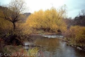
Park staff (303-730-1022) are very helpful and say that most of their nature programs can accommodate disabled participants. The Colorado Center for the Blind have frequent field trips here.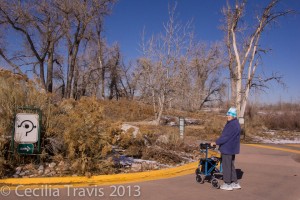
Wheelchair accessible Mary Carter Greenway at South Platte Park 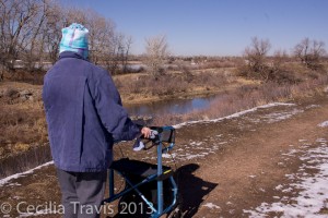
Viewing ducks on the South Platte River, South Platte Park Summit County
 Summit County maintains an extensive paved Recreational Pathway System, commonly known as the Recpath. Elevations range from 8,777 feet to 10,563 feet,
Thank you to Robert King who wrote, “There are many miles of paved, wheelchair accessible trails [in] Summit County Colorado that I did not see listed on your website. An introduction to all of them can be found at ….”Summit County Recreational Pathway website. Blue River Trail from North Pond Park
Thanks again to Robert King for the following post:
“The Blue River Trail runs 3.5 mi from North Pond Park through downtown Silverthorne, CO to the Lake Dillon Dam, where it connects with the Summit County Recreation path The Blue River Trail runs 3.5 mi from North Pond Park through downtown Silverthorne, CO to the Lake Dillon Dam, where it connects with the Summit County Recreation path. North Pond Park is located at the intersection of Highway 9 and Hamilton Creek Road. It is a wetland and pond area with fishing for humans and ospreys. There is a paved parking lot with handicap spaces along with 2 pavilions, restrooms, 2 docks, and a gas fire pit. Travel a short distance on the sidewalk along Hamilton Creek Road to the trail crossing. From there travel south toward the town of Silverthorne. The trail skirts housing developments as follows the Blue River. After 0.7 mi, the path goes onto a street and we turn back.”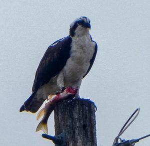
Osprey Dining on Sushi at North Pond ©Robert King Ten Mile Canyon is an 11.8 mile portion of the 55-mile long Summit County Recreational Pathway System. Robert King writes: “A paved recreation path runs about 6 miles through the Ten Mile Canyon between Frisco and Wheeler Junction. This posting is from the Wheeler junction area where we park in a gravel lot near the Curtain Ponds. There is no designated handicapped parking, but very few people use this lot so we always have enough room for our wheelchair van. To reach the parking lot, travel on I 70 to the Copper Mountain/Leadville/Highway 91 exit. Travel south on Highway 91 to the intersection with a traffic light at the entrance to the Copper Mountain ski resort. Turn East (left) at the light and drive a short distance past a coffee shop and service station to the end of the frontage road. Access the paved trail from the parking lot and turn left to travel East along Tenmile Creek. Always stay on the right side of the trail. The trail is pretty flat and you might see beavers, birds, wildflowers, butterflies, strawberries, raspberries, marmots, mountain goats, and fish depending on what time of day and time of year you visit. Fishing is popular in the beaver ponds and stream.”
Private
 The Discovery Pavilion of Chatfield State Park is operated by the Audubon Society of Greater Denver. The Audobon Discovery Loop trail can be 2.5 miles or less, depending on how many ponds you wish to walk around. Near the education center, there are interpretive trail makers, accessed by scanning with a smart phone. The trail as described in Pam and Dave Irwin’s Book “100 Best Denver Area & Front Range Day Hikes”. It is not wheelchair accessible and there are a few steps over water bars. There are a lot of social trails and we found it somewhat confusing. I veered off on one of these side trails and found a big pile of bear scat. There is a lot of poison ivy beside the trail.
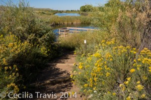
Audubon’s easy Discovery trail at Chatfield State Park 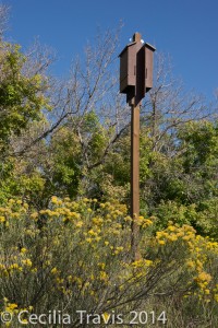
Bat houses at Audubon’s Discovery trail at Chatfield State Park Wilderness On Wheels
 Wilderness on Wheels is in the mountains on U.S. 285, sixty miles southwest of Denver or 3.8 miles west of Grant, Colorado.
There are fully accessible camping areas, fishing, picnic tables and an 8 foot wide boardwalk just over a mile long. Charging stations are placed at intervals along the boardwalk for electric wheelchairs. They are open from Memorial Day weekend to October 15th (as weather permits). This is a treat any time, but especially when the aspen are in fall color. Here is their website.
Phone 303-403-1110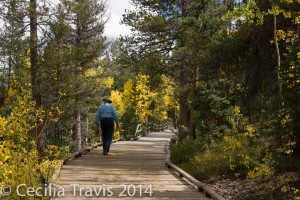
Boardwalk at Wilderness On Wheels, CO 
Wheelchair Accessible Campsite, Wilderness on Wheels CO 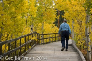
Fall aspen colors along ADA wheelchair accessible boardwalk at Wilderness On Wheels, CO 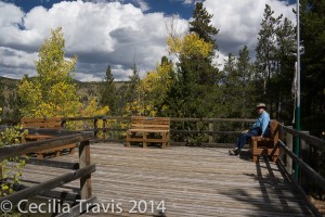
Overlook from ADA wheelchair accessible boardwalk at Wilderness On Wheels, CO
Miscellaneous
Day Hikes Near Denver has an “easy” classification with descriptions and directions. They do not address wheelchair accessibility.http://www.coloradotrail.org/index.html
Accessible Denver is a website which claims to be ” your source for disability-related information for those living in Denver or visiting the mile high city. Use the Resource Guide below to find medical services, businesses and professionals who provide information and assistance to the disabled community.” Not much here that pertains to this website.
The Continental Divide Trail is an amazing 3,100 mile trek from Mexico to Canada.
 You can walk a tiny portion of this trail, walking northwest from Lobo Overlook (altitude 12,000′). We were there the first week of October and there was too much snow for hiking, but I was told at least 1/2 mile is easy walking. However, the first 1/4 mile is downhill, which means you are coming uphill on the return. The 3 mile road to Lobo Overlook is off the summit of Wolf Creek Pass. The view alone is worth the drive, even if you don’t walk the trail. Here is a description from Trails.com and another from AllTrails.
Just Trails – Great source of information on trails in northern Colorado and southeastern Wyoming. They do mention difficulty, but not in reference to disabilities.
 Rebecca, who co-writes Just Trails, posted this list of wheelchair accessible trails near Laramie.
The National Sports Center for the Disabled has a hiking program called Summit Colorado. From their site: “Meet on Wednesday evenings to hike different trails around the Metro area. Once a month, join us on a day hike summiting one of Colorado’s majestic peaks.”
Nature For The Blind has a directory of Braille trails for almost every state in the US and for many other countries.
ORIC has a comprehensive review of outdoor activities in Colorado, some of which are for the disabled. I believe I have links to information they give for the latter, but the website is definitely worth a visit.
Peaks to Plains Trail
 The Peaks to Plains Trail project is will create a 65-mile trail that “will one day connect the South Platte Trail in Denver to the headwaters of Clear Creek at Loveland Pass. Once completed, it will connect four counties and seven cities, with a total elevation gain of more than 1 mile.” “The first portions of the Peaks to Plains Trail in Clear Creek Canyon Park opened in 2016 and 2017, offering four miles of 10-foot-wide paved surface right along Clear Creek. The next step will be continuing the trail east to Golden with the Clear Creek canyon Park – Gateway Segment. Here is Jefferson County’s website regarding the trail.
For more information from Jefferson County, call 720-893-1313. This project is a collaboration among multiple agencies, including the Colorado Department of Transportation. Here is CDOT’s map of the proposed and existing trail. Thank you to Robert King who brought this project to our attention.
The Rails-to-Trails Conservancy lists wheelchair accessible trails in Colorado.
The Colorado Trail
Most of the 500 mile Colorado Trail, which goes from Denver to Durango, is not accessible. However, there are a few places where you can follow it for short distances, at least on foot. Here is their website. The start of the Colorado Trail is at Waterton Canyon, a wide dirt road beside the South Platte River. Here is another link, and still another. I believe the first 6 miles are wheelchair accessible and there is an accessible fishing pier about a mile and a half from the parking lot. This is a road, not a trail, and you will meet a lot of bicyclists and runners, occasional cars and rattlesnakes. It can be very hot in the sun.
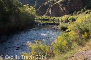
Waterton Canyon from wheelchair accessible road beside the South Platte River 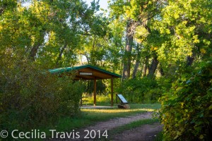
Accessible picnic shelter Waterton Canyon, Jefferson County Open Space CO  We walked about 1/2 mile east on the Colorado Trail from Kenosha Pass. We could have gone farther as it was easy walking, but the way was blocked by two fallen trees. This is a convenient place to enjoy the aspen colors in the fall. Parking lot: N39° 24.814′ W105° 45.277′ The trail going west from the highway becomes difficult almost immediately.
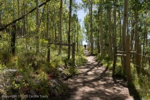
Start of Colorado Trail going east from Kenosha Pass  Another place to access the Colorado Trail is from the summit of Marshall Pass. It is easy walking for at least 1/2 mile going North from the summit.
Wheelchairtraveling.com is an outstanding resource.
