© JP Bruce
Washington has a lot of trails with minimal obstacles. Some are very easy and others are wheelchair accessible. Here are just a few of them.
Most of the links given were found through Internet search. Be sure to check out the wealth of resources listed under Miscellaneous. Some places I have been able to visit and a few have been recommended to me by other people who have been there. With your help, we can share our knowledge with disabled people everywhere and also increase awareness of the need for more accessibility. Please e-mail me with your suggestions using the form in the sidebar.
Federal
State
Local
Private
Miscellaneous
Federal
Accessible Adventures in the Pacific Northwest Videos The US Forest Service has produced a series of videos (33 as of August 2016) narrated by John Williams. These five to six minute videos visit National Forests and Scenic Byways in Washington and Oregon, letting you see just how accessible (or not) many of these wonderful places are.
Columbia River Gorge National Scenic Area
“The Columbia River Gorge National Scenic Area protects the spectacular canyon where the Columbia River cuts through the Cascade mountains – with cliffs and overlooks of Washington to the north and Oregon’s mountains and waterfalls to the south.”
Here is the Area website.
Map Video of Accessible Adventures phone (541) 308-1700
 Catherine Creek Trail #4400 is a one mile paved trail “with great views of the Columbia River on the south side of the county road. …….. Some individuals with disabilities may need assistance on the Catherine Creek Trail.” Here is a description from OregonHikers.org. This is part of the Burdoin/Coyote Wall/Catherine Creek Recreation Area Day hiking trails
St. Cloud Trail #4410 is a “Short loop through an old apple orchard. Interpretive signs explain the historical importance of the area.”
Sandy River Delta Trail #4417 is a 1.1 mile compact gravel trail to the Sandy River Confluence bird blind site. Map
Balfour-Klickitat Trail #4414 0.7 miles. “….offers unique views of the Columbia and the Klickitat rivers as well as wildflower and birdwatching opportunities.” The trail is “paved and accessible with a 0-15% gradient. Most of the trail is ADA accessible; some people with disabilities may need assistance.” Described by OregonHikers.org.
Sams Walker Trail #4402 a 1.1 mile loop. “…good views of the Oregon side of the Gorge and picnic tables at the viewpoint. It is 3 feet wide and surfaced with crushed gravel.” Described by OregonHikers.orgIdaho Panhandle National Forests
The 2.5 million acres of the Idaho Panhandle National Forests contain mountains, lakes, rivers, waterfalls, ancient cedar groves, and an abundance of wildlife. From NationalForests.org: “The Idaho Panhandle National Forests are an aggregation of the Coeur d’Alene and portions of the Kaniksu and St. Joe National Forests. There are eight local points of contact including the Supervisor’s Office, six district offices and the Coeur d’Alene Tree Nursery.” The Forests extend into eastern Washington and western Montana. Supervisor’s Office phone 208-765-7223. See their website for District Rangers’ phones. Publications
Pulaski Tunnel Trail The forest service says that the first 725 feet of trail are accessible to visitors with disabilities.
 Hobo Cedar Grove Trail From the website: “The trail has a gentle gradient making it accessible to older persons or those with moderate physical impairments. The trail width is about 40 inches. An occasional log bench provides seating along the trail.”
Hiawatha Rail Trail is not listed in the Rails-to-Trails site, but I have seen references to wheelchair use. Call 208-744-1301. Here is some more information from the Friends of the Coeur d’Alene Trails. You can also give the Forest Service a call at (208) 765-7223.
Mineral Point Trail is 2.1 miles one way and described as “….one of the most beautiful trails on the Sandpoint Ranger District and is popular with hikers and mountain bikers. Gentle grades, wildflowers and excellent views make this trail suitable for the entire family.”
Sam Owen Trail is “wheelchair moderate, hiker easy……The first ½ mile of this trail has a hardened surface that is suitable for wheel chairs and strollers. The hardened trail ends at a beautiful vista of Owens Bay and the benches offer a nice place to sit and enjoy the view. The remaining ½ mile of trail is native surface, narrow and not suitable for wheel chairs or strollers…..This is a great hike for a family with small children. ”North Cascades National Park Complex
The North Cascades offer forested valleys with cascading waters, alpine landscapes with lakes and jagged peaks, and more than 300 glaciers. All this less than three hours from Seattle.
Here is the Complex website. Accessibility Phone 206-526-6677 Maps North Cascades and Mt. Baker Visitor Guide
Mt. Baker-Snoqualmie National Forest
“Located on the west side of the Cascades between the Canadian border and Mt. Rainier National Park, you will find glacier-covered peaks, spectacular mountain meadows and old-growth forests rich in history and outdoor opportunities.”
Here is the Forest website. Phone 425-783-6000 Links to Motor Vehicle Use Maps List of “Family friendly ADA accessible trails” Stevens Greenway: Accessible Adventures videoBaker Lake and Mt. Baker National Recreation Area
Shadow of the Sentinels 0.5 mile interpretive trail through old growth forest.Sterling Munro Trail 330 feet boardwalk with view of Picket Range.River Loop 1.8 milesRock Shelter Trail 0.3 mile “…to Native American campsite above Newhalem Creek, moderate grade.”
Gorge Overlook Trail 0.5 mile (0.2 mile is paved), Views of Gorge Lake and Dam.Happy Creek Forest Walk 0.3 mile boardwalk through ancient creekside forest.Rainy Lake Trail 1.0 mile paved trail to lake with views of waterfall.Washington Pass Overlook Trail 810 ft. loop trail with “…view of mountains from a high bluff. ”Glacier Area
Boyd Creek 0.25 mile Interpretive trail focused on fish habitat.Heather Meadows Area Accessible Adventures video
Picture Lake 0.5 mile interpretive loop.Fire and Ice 0.5 mile interpretive loop.Artist Ridge 1.0 loop to viewpointOkanogan-Wenatchee National Forest
“The Okanogan-Wenatchee National Forest is a large and diverse landscape, encompassing over 4 million acres along the east slopes of the Cascade Range in Washington. “
Here is the Forest website. Interactive Visitor Map Phone 509-664-9200
“The Cascade Lookout 2015” 23 pages of information about the Forest.
Chelan Ranger District Phone 509-662-4900
Ten Mile Falls Trail 1.0 mile The trail “…winds around large rocks, through aspen and Douglas fir forests to a view point where you can rest on the benches available and look out to Copper Peak and over the Copper Creek Valley. Go another 0.2 of a mile to find yourself on a viewing deck overlooking 10 Mile Falls.”Methow Valley Ranger District Phone 509-996-4003 Accessible Adventures video
Rainy Lake Trail 0.9 miles flat paved trail to a picnic spot. “High cliffs surround the lake, with waterfalls cascading down to the lake. In the fall, the golds and reds of the changing shrubs and trees are spectacular.”Naches Ranger District Phone 509-653-1401 Accessible Adventures video
Boulder Cave River Trail 0.75 paved loop trailClear Lake Trail 1.0 mile paved trail, fishing piers, bird watching blinds, and picnic area. “The asphalt trail takes you along the lake and through the woods to see wildflowers and if you’re quiet maybe an elk or deer.”Pleasant Valley Interpretive Trail 1.0 mile. Paved. Views of American River.Mather Memorial Parkway East Portal. 0.25 mile paved trail.Tonasket Ranger District Phone 509-486-2186
? Big Tree Trail 1.0 mile. “Easy”. The trail “…travels 1 mile from Lost Lake Campground to the Big Tree Botanical Trailhead and Interpretive Site, then continues 0.7 mile around the loop at the Big Trail Interpretive Site where the trail highlights two 900 year old Western Larch trees with a couple of benches to take in the surrounding Western Larch and other conifer species.” “Great trail for the whole family.” The Interpretive site is accessible, I am not sure about the trail.Wenatchee River Ranger District Phone 509-548-2550
Hidden Lake 0.75 mile “Easiest” . “The trail climbs very gently through dense forest, and provides good opportunities for nature study with small children. Once it reaches Hidden Lake, the trail becomes brushier and harder to follow as it curves along the lake’s north shore, and it ends at a lovely waterfall at the lake’s west end.”
Icicle Gorge 3.6 mile interpretive loop 200 ft elevation change. “Easiest”.Olympic National Park –
“The Olympic Mountains are host to montane forests giving way to subalpine meadows, rocky alpine slopes and glacier-capped summits. …Linking ocean and land ecosystems, rivers and streams provide a highway for fish and other wildlife to move both up and downstream….The park protects one of the largest remaining blocks of old growth forest and temperate rain forest in the lower 48 states….From sandy beaches to rocky offshore islands, Olympic’s shoreline harbors a wealth of marine and intertidal communities.”
Here is the Park website. Phone 360-565-3130 Link to Maps and Brochures Park Map
Although some of these trails have little elevation gain, mosses, mud, and wet rocks and roots can make them challenging. Accessible Adventures video
Elwha
Madison Falls 0.1 mile one way paved trail to a 60 ft. waterfall.? Smokey Bottom Trail 1.9 miles one way. “Winds through forest above former Lake Mills.” Although there is only 18 ft. elevation change on this trail, it may have difficult footing. Call to find out.
Dosewallips
? Terrace Loop “Easy 1.2 mile loop through forested terraces above the Dosewallips River. Elevation gain 200 feet.”
Deer Park
? RainShadow Loop 0.5 mile self guided trail to top of Blue Mountain. Elevation gain is 170 ft and I do not know how difficult the path is. Call first.
Hoh Rain Forest
Mini Trail 0.1 mile “…flat, paved, accessible-with-assistance loop in old growth rain forest.”
0.8 mile “…easy loop through old growth temperate rain forest, with 100 foot elevation gain.”
? Spruce Nature Trail 1.2 mile loop. “…loop through temperate rain forest to Hoh River. Less than 100 foot elevation gain.” Could be difficult footing.
Hurricane Ridge
Cirque Rim 0.5 mile one way. “Easy paved trail with views of Port Angeles and the Strait of Juan de Fuca. Wheelchair accessible with assistance.”
Big Meadow 0.25 one way “Easy paved trail crosses open meadows with views of the Olympics. Wheelchair accessible with assistance.”
Hurricane Hill. The first 0.25 miles of this 1.6 mile trail is wheelchair accessible with assistance. Paved.
Kalaloch
Kalaloch Nature Trail 1.0 mile “…easy loop through coastal forest, with stairs and elevation change less than 40 feet.”
Ruby Beach and Beach 4 have accessible overlooks.Lake Crescent
Moments in Time 0.6 mile loop 0.6 mile loop “Self-guided nature trail through forest and by the lake, 0.6 loop none accessible with assistance.”
Mora Area
Rialto Beach 200 ft path to ocean view. “Temporary accessible ramp available in summer season.”
Quinault
Maple Glade 0.5 mile flat loop through a mossy bigleaf maple grove. Accessible with assistance, but not fully ADA.
Kestner Homestead 1.3 mile loop. Accessible with assistance, but not fully ADA.
Staircase
Shady Lane 0.9 mile trail to Four Stream Road and Lake Cushman. First 0.1 mile is accessible.
Staircase Rapids Loop 2 mile trail of which “The 0.6 miles to the Big Cedar, and the 0.5 mile section to a river viewpoint are accessible with assistance.”
State
The Washington State Accessible Outdoor Recreation Guides:
Coastal, Southwest, South Puget Sound, North Puget Sound, Island, Northwest, North Central, South Central, Northeast, Southeast
Washington State Parks ADA Recreation Map
Washington has over 100 State Parks. About 34 of these have ADA accessible trails. I am only posting about a few. Here is Washington State Parks’ searchable ADA Recreation Map. Click on each state park to see what ADA amenities are available. If you have a favorite accessible or just very easy trail in a state park I don’t mention, please let me know and I will add it to this website.
The Discover Pass, required for Washington State Parks and other State lands, is not needed by those holding Disability placards and license plates.Beacon Rock State Park
“Beacon Rock overlooks a breathtaking section of the Columbia River Gorge, a deep, wide gouge in the earth carved by Ice Age floods. Now, the mighty Columbia rushes down to the ocean in a froth of whitecaps, bisecting Washington and Oregon, with walls of columnar basalt and mountains rising thousands of feet on both sides. ”
Here is the Park website. Phone 509-427-8265
 Little Beacon Rock Trail 0.5 mi. round trip ADA compliantHadley Trail 1.18 miles round trip ADA compliant
Cape Disappointment State Park
“Hike through old-growth forest or around freshwater lakes, saltwater marshes and ocean tidelands. … The beaches at Cape Disappointment also lure kite-fliers, sand-castle builders and those who love to walk and explore.” There are eight miles of hiking trails. The website claims an ADA compliant trail, but does not say which of the seven trails it is. Neither the brochure nor the map give indications of the difficulty of the trails.
Here is the Park website. Phone 360-642-3078 Brochure Map On EveryTrail.com
Cape Disappointment Trail 1.2 miles OregonHikers.orgColumbia Plateau Trail State Park
“The Columbia Plateau Trail is a 130- mile corridor and 4,109-acre day-use area located on an abandoned railroad right-of-way in eastern Washington. Currently, 23 miles of the trail between Lincoln County and Cheney and 15 miles in Franklin County are developed and open for public use. ”
Here is the Trail website. Brochure. Columbia Plateau State Park South (main) Office 509-646-9218, Riverside State Park (north portion only) 509-465-5064
“The 3.75-mile trail section from Fish Lake Trailhead to Cheney Trailhead has an asphalt trail surface and is great for hiking, bicycling and inline skating. The remaining 19.25-mile trail section from Cheney Trailhead to Martin Road Trailhead has a crushed rock trail surface and is useable by horseback riders, mountain bikers and hikers. Both trails are ADA accessible”Deception Pass State Park
“Deception Pass State Park spreads over 3,854 acres, a marine and camping park with 77,000 feet of saltwater shoreline and 33,900 feet of freshwater shoreline on three lakes. The park is actually located on two islands — Fidalgo to the north and Whidbey to the south. The Canoe Pass and Deception Pass bridges connect the two islands, creating a gateway for exploration.”
Here is the Park website. Phone 360-675-3767 Brochure
Whidbey Island
Sand Dunes Interpretive Trail ADA compliant paved 1.2 miles round trip. Cranberry Lake Trail 1 mile one way? Upland Interpretive Trail 0.25 mi. round trip
Lincoln Rock & Wenatchee Confluence State Parks
Both Lincoln Rock and Wenatchee Confluence Parks are camping parks. The south section of Wenatchee Confluence is a designated natural wetland area.
Here is the Lincoln Rock State Park website. Phone 509-884-8702 Brochure
Here is the Wenatchee Confluence State Park website. Phone 509-664-6373 Brochure
Rocky Reach Trail, a paved, mixed-use ADA-accessible trail “…connects to the Apple Capital Loop Trail, a paved walk/bike path that stretches southwest to Wenatchee Confluence State Park, encircles the Wenatchee and East Wenatchee riverfronts and extends south to Rock Island Hydro Park. Altogether, these trails offer more than 20 miles of walking, jogging and bicycling fun. ”Palouse Falls State Park
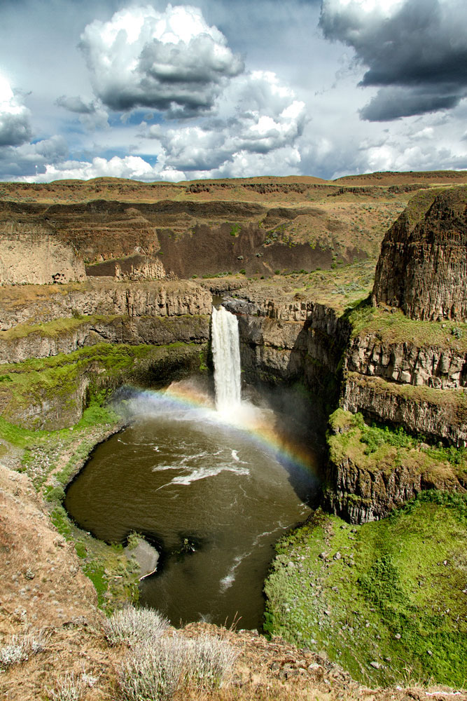
“The Palouse River runs through a narrow cataract and drops 200 feet to a churning bowl. From there, the current moves swiftly, through a winding gorge of columnar basalt, to its southern end at the mighty Snake River.”
Here is the Park website. There is no phone service at the park, and staff and volunteer hosts are not always available. Brochure Phone for information 509- 646-9218
There is a 0.1 mile ADA trail to a view of the falls. Thank you, JP Bruce for the suggestion and the photo.Wallace Falls State Park
“Wallace Falls State Park is a 1,380-acre camping park with shoreline on the Wallace River, Wallace Lake, Jay Lake and Shaw Lake. Located on the west side of the Cascades, the park features a 265-foot waterfall, old-growth coniferous forests and fast-moving rivers and streams.”
Here is the Park website. Phone 360-793-0420 Brochure Map
Although the Park touts its ADA trail, neither the brochure nor website say which trail it is. I suspect it is the Small Falls Interpretive Trail 1.5 miles round trip.
Local
Bellevue
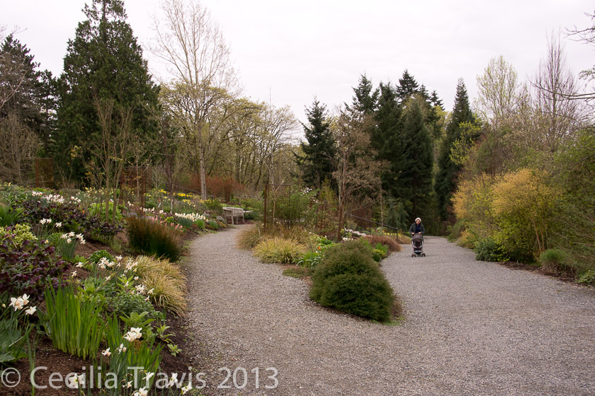
Bellevue Botanic Garden
The Gardens and paths are beautifully designed to give a feel for the natural ecology of the area. There are accessible restrooms at the visitor center. Many of the gravel/mulch trails are hilly so severely limited people may wish to remain on the upper parts, near the parking lot, although power wheelchairs should be able to negotiate most of the trails which are hard-packed fine gravel and ADA compliant. Call them for details: 425.452.2750. Here is the Gardens’ website.
Trail & Accessibility Guide
ADA Accessible Trail Bellevue Botanic Garden, Bellevue WA 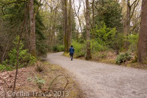
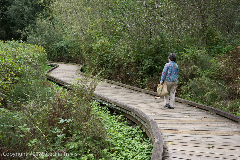
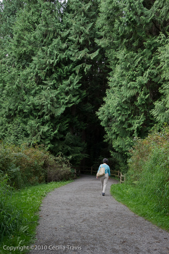
ADA Accessible Trail Bellevue Botanic Garden, Bellevue WA Lake Hills GreenbeltThe accessible mile long part of the Lake to Lake Trail that is in the Lake Hills Greenbelt in Bellevue takes you through a wetland, a blueberry farm and into cedar woods. You can park at the Ranger Station GPS N47° 365.800′ W122° 08.057′ or at the fruit stand GPS N47° 36.199′ W122° o8.554′.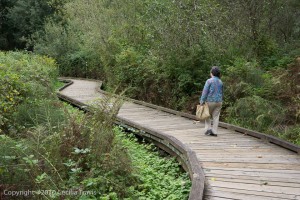
Accessible Boardwalk, Lake Hills Greenbelt, Bellevue WA 
Interpretive sign on boardwalk, Lake Hills Greenbelt 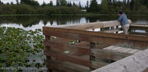
Accessible Fishing Pier, Lake Hills Greenbelt 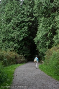
Accessible path into cedar forest, Lake Hills Greenbelt, Bellevue WA City of Seattle
The application “Seattle Trails” shows you where all the official trails in Seattle are. It is a collaboration between Seattle Parks & Recreation Department, Seattle Trails Alliance and volunteer software developers. Here is a link to a page from which you can download the app.
Here is the website for Seattle Parks. 206-684-4075
Accessible, easy Wetland Trail in Carkeek Park, Seattle WA ©Elizabeth Armbrust Carkeek Park
“This popular park offers extraordinary views of Puget Sound and the Olympic Mountains. Explore the secrets of this northwest Seattle watershed, nine miles from downtown. Here, 220 acres of lush forest, meadows, wetlands, creeks, and beach are formed by the magic of water and time. ”
Here is Carkeek’s website. Trail Map Phone 206-684-0877 Washington Trails Association Yelp
Salmon to Sound Trail, 0.3 mile “The trail gradually ascends along Mohlendorph Creek on a nice gravel path to a salmon restoration area. The trail continues beyond, and becomes narrower and less traveled. The trail ends at Venema Creek.” From HikingProject.
Piper’s Creek Trail from Lower Meadow to Piper’s Orchard “The trail is an easy, gently graded gravel or paved trail, starting at a playground.” From Hiking Project. “Piper’s Creek and North Traverse Trail Loop is a 2.1 mile moderately trafficked loop trail…good for all skill levels” From AllTrails.
South Ridge, Hillside, Brick Road and Piper’s Creek Trail is a 1.1 mile moderately trafficked loop trail …good for all skill levels.” From AllTrails.
? Wetland Trail 0.2 miles The Wetland Trail is hard packed gravel with a section of wide boardwalk with railings.Kubota Garden
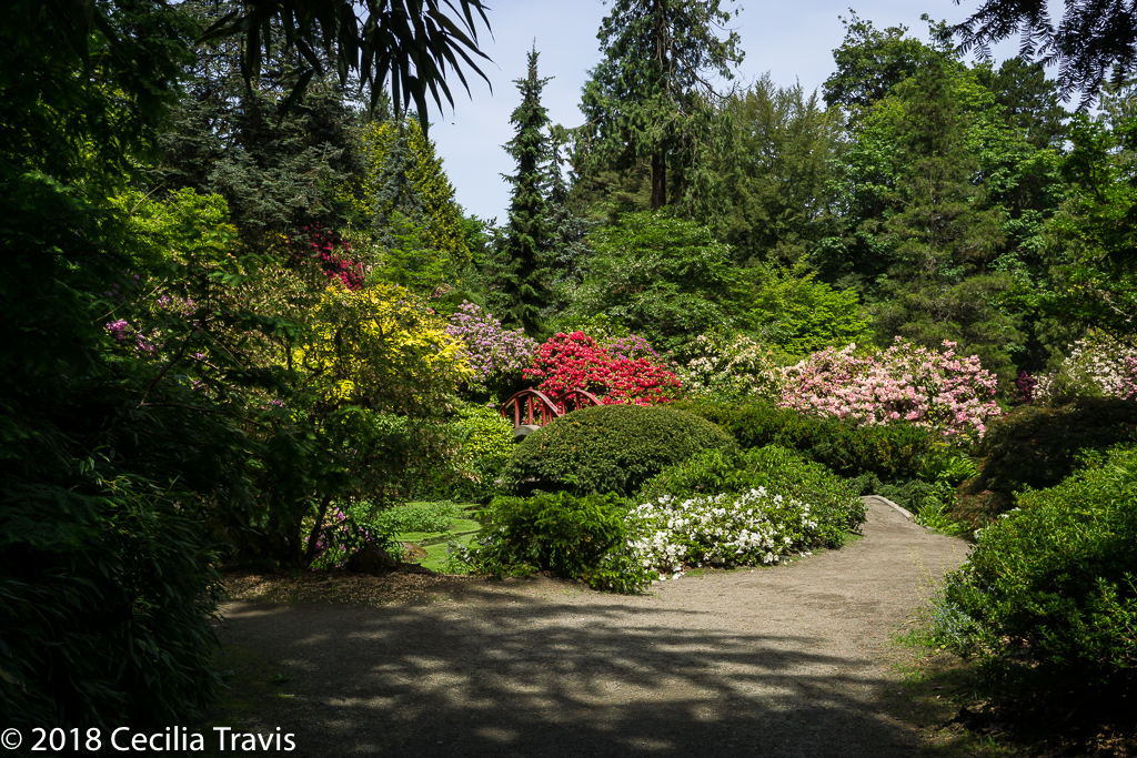
Hidden in South Seattle, Kubota Garden in south Seattle is a “…stunning 20 acre landscape that blends Japanese garden concepts with native Northwest plants. …. The Gardens are a spectacular setting of hills and valleys, interlaced with streams, waterfalls, ponds, bridges, and rock out-croppings with a rich array of plant material”
Not all the trails at the Garden are accessible, but you can make your way around this beautiful place without being completely stopped by obstacles. Here is their website. Phone 206-684-4075 Map and Self-Guided tour
Kubota Garden Seattle WA ©2018Cecilia Travis 
Kubota Garden Seattle WA ©2018Cecilia Travis Here are AllTrails’ Best Wheelchair Friendly Trails Near SeattleResearching trails in Seattle is proving more difficult than I would have expected. Here is an interesting article from the Seattle Times describing one man’s favorite parks with trails.
Tacoma
Tacoma Nature Center
“The Tacoma Nature Center is a 71-acre nature preserve encompassing Snake Lake and the surrounding wetlands and forest….More than two miles of soft-surfaced walking trails wander through the wetlands and forest areas.”
Here is the website for the Center. Phone 253-591-6439 Accessibility Information Trail Map
First Bridge Loop Trail 0.5 mileVancouver WA
Vancouver has a searchable map of Parks and Trails. Using “Natural Areas” came up with six areas, all of which look as though they might have easy trails. Call Vancouver Parks for more information. 360-487-8311
? Burnt Bridge Creek Trail is a 8.1 mile one-way hard surface trail. Description by OregonHikers.org: “The trail heads along grassy wetlands, some forested areas, and a few sections of sidewalk. ……….However, there are numerous access points to the greenway, and it can be conveniently divided into three parts; distances given for each section are round-trip. Note that some street crossings and trail sections, e.g. in Leverich Park, are a little sketchy for wheelchairs.”
Map Here is the website for the Trail.


Private
Adriana Hess Wetland Center
“The Adriana Hess Wetland Park is a small park with loop trail, a shelter, benches and a viewing platform over Morrison Pond.”
Here is the Center website. Phone 253-565-9278 Address: 2917 Morrison Rd W
University Place, WA
Donna Cooper Pepos Native Plant Trail ” The trail was established in 1999 as a demonstration backyard habitat area featuring native plants of the Pacific Northwest.” ADA – compliant
Miscellaneous
5 Accessible Hikes for Outdoor Lovers with Disabilities
Here are five hikes recommended by the family of a North Bend teen with cerebral palsy.
“About Accessibility in Washington State” : A collaboration between Washington’s Recreation and Conservation Office, the Department of Fish and Wildlife, the USDA Forest Service, Department of Natural Resources, Olympic National Park and the State Parks and Recreation Commission has put together guidelines for outdoor recreation. They rate everything from campsites, picnic sites, places for fishing and hiking to bathrooms and wildlife watching as:
Accessible: Based on criteria within the Americans with Disabilities Act Accessibility Guidelines (ADAAG). Facility is connected with barrier-free-route-of-travel from an accessible parking area. Due to topography and the primitive nature of some sites, these routes may not be accessible to all with disabilities.
Useable: Facility allows significant access. Some individuals with disabilities may have difficulty and need assistance.
Non-Accessible: Does not meet ADAAG criteria.
Access Recreation Here is a wonderful project in Washington and Oregon.
“Access Recreation [AR] is a Portland, Oregon ad hoc committee that has been developing uniform guidelines for minimum information that should be provided about hiking trails and outdoor recreational facilities, that would benefit hikers with disabilities. These guidelines can be applied to websites, printed materials and at trail sites. …..When put into place, these guidelines will provide the public with easy access to better information on the accessibility of recreational and hiking trails in the states of Oregon and Washington and nationwide.” Georgena Moran, founder and project coordinator, says it is a “two-year project [ends June 2016] and as for now only two trails have been trail mapped the with video accompaniment.” Article by Georgena, “Trails for Everyone”.Washington Trails Association
Here is a wonderful set of ADA-Accessible Trails from the Washington Trails Association.Disabled Hikers is “… a disability-led organization building community and justice in the outdoors. The website includes detailed trail guides – currently primarily in the PNW but we accept submissions from anywhere.” Thank you to founder Syren Nagakyrie for telling us about it. She “also leads group hikes and provides other resources and does advocacy work.”
Nature For The Blind has a directory of Braille trails for almost every state in the US and for many other countries.
Oregon Hikers Forum is a service of the Trailkeepers of Oregon, a non-profit organization. They provide this marvelous Find a Hike page where you can put in your parameters to look for suitable hikes in Oregon and the Pacific Northwest. I chose easy Family hikes with an elevation gain less than 500′ and came up with 186 trails. Limit that to 2 miles or less and you get 81. The Trailkeepers also have the online Oregon Hikers Field Guide for hiking in Oregon and Southern Washington.
The Rails-to-Trails Conservancy lists wheelchair accessible trails Washington.
“Lots of options for wheelchair, stroller recreation” This is a useful article from The Oregonian, by Terry Richard published March 23, 2008 and updated November 16, 3009.
Washington State Accessible Trails is a privately maintained website that covers a lot accessible outdoor locations in Washington and other states as well.