Rocky Mountain National Park
Rocky Mountain National Park’s accessible trails include Lily Lake Trail, Sprague Lake Trail, Bear Lake Trail, Coyote Valley Trail and the Holzwarth Historic Site Access Road. There is also a paved trail to the Forest Canyon Overlook. This high altitude park is 415 square miles of beautiful mountain country, easily reached from the northern Front Range Cities. Stop by a Visitor Center to learn about easy trails that might work for you. Phone 970-586-1206 Park Brochure Park Website Description in The Disabled Traveler’s Companion. Accessibility page from the Park Service.
Wheelchair Accessible Trails described by RockyMountainNationalPark.com This web site is not affiliated with the National Park Service or National Forest Service, but looks pretty useful. They also have information on Roosevelt and Arapaho National Forests and the neighboring communities of Estes Park and Grand Lake.
The drive over Trail Ridge Road goes above timberline to 12,000′ altitude giving you a chance to experience the tundra and distant mountain views without needing to hike. However, even walking may leave you short of breath at this altitude.
![]() Sprague Lake 0.75 mile around the lake. There is a striking view of the Rampart to the west.
Sprague Lake 0.75 mile around the lake. There is a striking view of the Rampart to the west. ![]() This trail is open in the winter and the snow is usually packed down so you can walk it using poles and with spiked treads attached to your boots. For those of use who can’t ski anymore it is wonderful to get out and experience some winter.
This trail is open in the winter and the snow is usually packed down so you can walk it using poles and with spiked treads attached to your boots. For those of use who can’t ski anymore it is wonderful to get out and experience some winter.
![]() Bear Lake 0.89 mile loop around popular Bear Lake.
Bear Lake 0.89 mile loop around popular Bear Lake.
![]() Coyote Valley 1 mile round trip in the Kawuneeche Valley, downstream from the Colorado River’s headwaters in the Never Summer Mountains.
Coyote Valley 1 mile round trip in the Kawuneeche Valley, downstream from the Colorado River’s headwaters in the Never Summer Mountains.
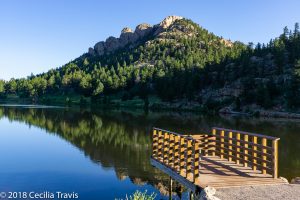
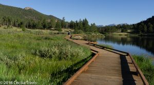
![]() Lily Lake Trail 0.8 mile – a pretty loop around the lake. You can reach it off of highway 7 south of Estes Park and although it is administered by the Park Service, there is no fee.
Lily Lake Trail 0.8 mile – a pretty loop around the lake. You can reach it off of highway 7 south of Estes Park and although it is administered by the Park Service, there is no fee.
GPS at parking lot N40° 18.404′ W105° 32.270′


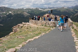
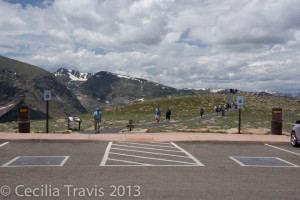
![]() Forest Canyon Overlook in Rocky Mountain National Park is fully wheelchair accessible and has beautiful views of the canyon below and Longs Peak in the distance. GPS at parking lot N40° 23.731′ W105° 12.691. Trail Ridge Road is closed in winter and early spring.
Forest Canyon Overlook in Rocky Mountain National Park is fully wheelchair accessible and has beautiful views of the canyon below and Longs Peak in the distance. GPS at parking lot N40° 23.731′ W105° 12.691. Trail Ridge Road is closed in winter and early spring.

